In April, 1917, US President Woodrow Wilson issued a challenge to his country. World War I was raging in Europe, and Allied shipping was being torn apart by German surface ships and submarines. As a result, the US churned out over a thousand wooden-hulled cargo ships in about 18 months.
 The war ended in November, 2018, and many of those ships found service in peace-time as ferries and commercial cargo-carriers. Many, however, were labelled “surplus”. Some were damaged, many worn out, and many simply were completed too late to be useful.
Mallows Bay, a shallow Bay on the Potomac River south of Washington, DC (across the river from Quantico, on the Maryland side near Nanjemoy), became one of the many places where these old ships, and others, came to die. Today, the remains of almost 200 ships still rest in a very small area that can be paddled in about 2.5 hours. Most, but not all, come from the years during and just after World War I, but a few date from as late as the 1930s.
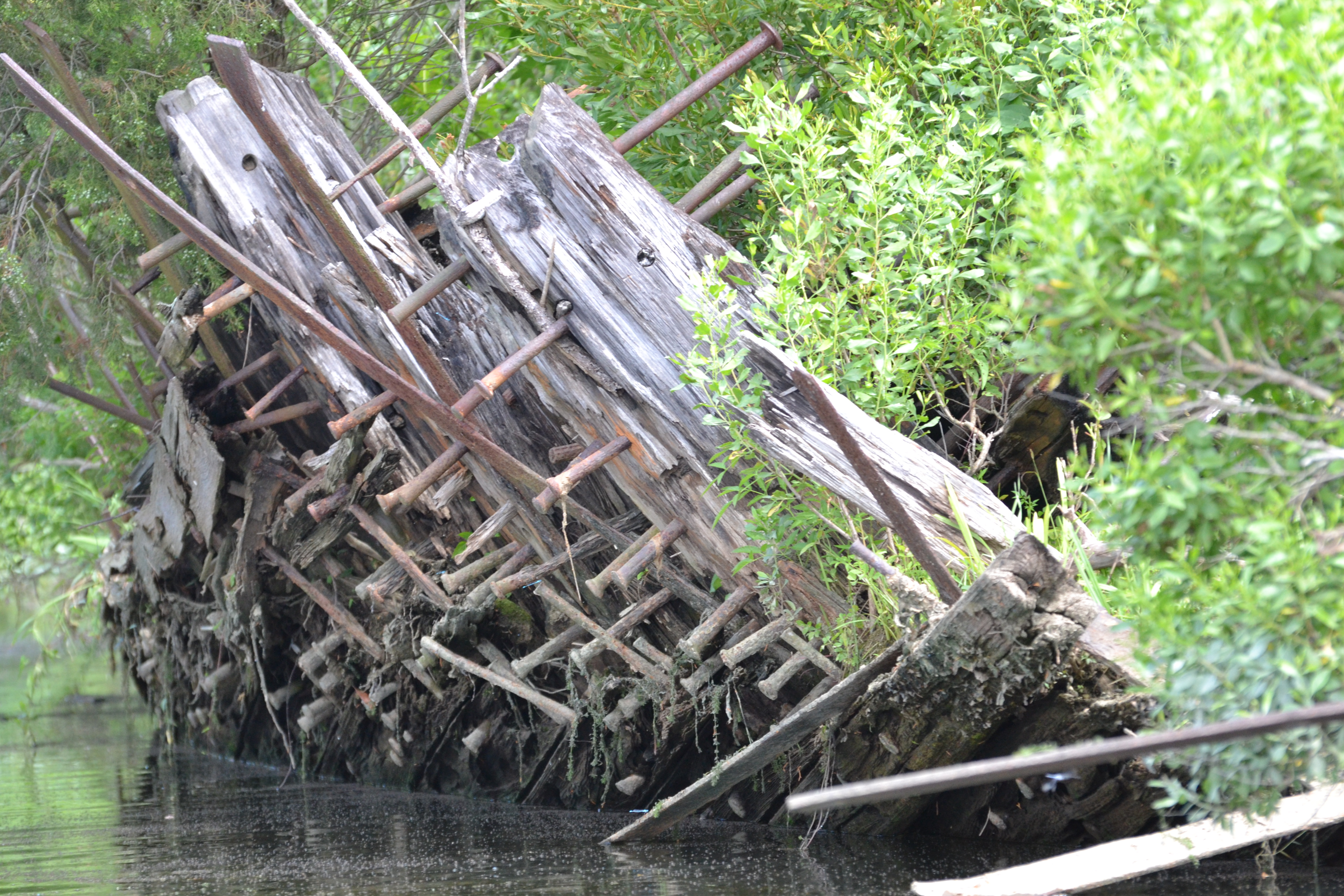
 If you are imagining yourself paddling among towering hulks – that’s not what Mallows Bay looks like. Instead, picture the ghostly outline of hulls that sit just above the waterline at low tide. These ships have seen the ravages of time. And many were burnt to the waterline inside the “Burning Basin” established by Bethlehem Steel to salvage metal and destroy the rest. These ships are ghosts, and the most impressive among them hold their bulk and stature largely because of the growth of trees and shrubs on top of them.
 In 2015, this hotbed of nautical archaeology was placed on the National Register of Historic Places, and it is now up for consideration as a National Marine Sanctuary. Between the history, and the wildlife (bald eagles, osprey, herons, beavers, otters, raccoons, etc), it’s a great place to explore in a canoe or kayak. It IS exposed to the big water of the Potomac – so pay attention to the weather, particularly wind, and tide. Low tide is the best time to see the ships – but at any water level, there is a risk of snagging your boat on submerged hulls. Take care.
Also, during the summer, the inner parts of the Bay become filled with hydrilla, a dense aquatic weed. This makes the inner bay impassible by anything with a motor, and challenging for paddlecraft. Spring and fall offer better passage, and clearer water as well. For all that, my recent trip was on July 8, and while the hydrilla was present, it wasn’t awful.
 The Chesapeake Conservancy has an excellent web site on the ships of Mallows Bay. Scroll down to the section called “Story Maps” for links to suggested routes that include a little history on some of the more prominent vessels. Regardless of your route, you can plan on a put-in at the landing (38.468937, -77.263625) and a break at the north end of the Bay on a gravel bar known as Grady’s Spit.
On our recent trip, we launched at low tide, on a calm day, and headed straight out into the river (along the path of the “Outer Passage” itenerary), paddled to Grady’s Spit for a lunch break, back along the shoreline “Inland Passage” and then into the Burning Basin to wrap up – GPS Data Here. This allowed us to tackle the open water when we knew it was calm, and avoid fighting the incoming tide by staying in the shallows on the way back. A YouTube link to our journey is below.
Mallows Bay is a great place to spend an afternoon on the water – whether it be for history, wildlife, or both!
Get Out There
Troy
flying-squirrel.org


One thought on “Paddling Mallows Bay”