The Rappahannock is one of Virginia’s classic rivers. Steeped in history, the tidal portions of the river downstream of Fredericksburg were home to the native Rappahannock tribe encountered and documented by Captain John Smith in the early 1600s. They gave this river its name, an Algonquin word meaning “water that rises and falls”. Upstream, above the fall line in Fredericksburg, the river served as the physical boundary between north and south for much of America’s Civil War. The area is dotted with famous battlegrounds – Chancellorsville, Spotsylvania, the Wilderness, even Manassas/Bull Run, and Fredericksburg itself.

The river is also a beautiful paddling river. Draining an area east of the Blue Ridge, south of the Potomac and north of the James, it’s not Virginia’s largest river system, and it tends to rise and fall quicker than the larger rivers. The Rappahannock is wide enough to spread out in, though narrow enough – and with banks that are generally protected, wild and natural – to give the sense of a wilderness journey, just outside of town. Because of this wild feel, camping opportunities abound on both banks, and on islands. It’s also a good fishing river, with extremely clear water – I caught a couple nice smallmouth bass during some of our float breaks without trying very hard.
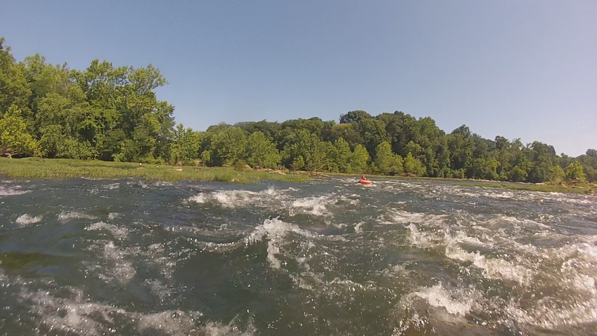
On June 10-11, 2017, I had the opportunity to paddle and float (via tube) almost 12 miles of the river with the Virginia Outdoor Center (VOC), in Fredericksburg. They’re a great outfit, wonderful people, and they showed my group a wonderful time and hospitality – to Bill, Denise, Zach, Joellen, and all the staff, I offer thanks and appreciation! If you want to see the river the easy way, with shuttles and boat rentals, not to mention access to points on the river not publicly available, give them a call. (We went 10 miles from Hole in the Wall, a private access point, to VOC, where we camped, then tubed from VOC to Old Mill Park in Fredericksburg the next morning. The tubing, by itself, was a blast, and worth a quick stop in on a summer afternoon!)
I’m working on a video of our particular adventure that will give a better feel for the river. It’s not quite ready, but I hope to get it up on my YouTube channel before long.
All that said, I’m going to focus this writeup on areas where you can do it yourself – from Mott’s Run Landing to Old Mill Park, about 5 miles with steadily increasing drops, technical challenge, and fun!
River Miles: 4.5
Shuttle Miles: 5
Put-In: Mott’s Run Landing (38.31367, -77.54119)
Takeout: Old Mill Park, Fredericksburg (38.31894, -77.46880)
Difficulty: Class I-III
Slope: 13 feet-per-mile above Falmouth, 30 feet-per-mile through Falmouth over the fall line
Water Range: Min 2.4 feet, Max 5 feet on the Fredericksburg Gauge.
Hazards: Strainers and trees near I-95, potential logs in river at Target Rock.
GPS Data: As described above, I ran this in two parts that overlap this section. So captured GPS is broken into Hole In The Wall to VOC; and VOC to Fredericksburg
 Mott’s Run is a public boat landing just west of Fredericksburg. There’s plenty of parking and easy access to the river, and it’s popular with those just playing in the river, as well as a put-in or take-out for boaters. (Upstream, between this point and the confluence with the Rapidan, the river has good current and pleasantly spaced Class I rapids to keep you moving and keep things interesting, with Confluence Rapid itself providing a good Class II challenge. With all the camping options you can do some really nice trips of 20 miles or more, but that’s an adventure for another time).
 Below Mott’s, you have about a mile of smooth (but moving) water to get accustomed to your boat, before hitting “Pettiman’s Camp”, the first of many Class I sections where you have to start paying attention to rocks. Just around the corner, you’ll encounter “Maze Rapid”, a long Class I slide with large rocks interspersed, giving the paddler many route options.
About a mile after the Maze, things start to heat up as you come right around a bend and spot the Interstate 95 bridge. The water accelerates here and keeps moving for about a mile. Just before the bridge, you navigate the “Interstate Z”, starting center, then angling

Approaching the drop at Iron Ring, just below I-95. Aim left of the big rock in river center.
right along a fin of rocks before cutting back left down a wide chute just upstream of the bridge and a natural collection point for logs and other debris. As you pass under the bridge, keep left to hit a nice Class II drop over “Hunter’s Dam” a remnant of a colonial-era ironworks, then aim for the giant whale-shaped rock in the middle of the river. Right of this rock, the boulder is undercut, there are strainers and other hazards – stay clear of that. But just left of it there are a couple nice drops that make up the Class II “Iron Ring Rapid”, or alternately, “Carter Never Saw It”. (There used to be a 20-foot dam downstream that buried this entire section of river under a lake. The dam was destroyed in 2004, setting the river free and revealing these nice drops!). After Iron Ring, the river drops over a few more small ledges, then gives you a breather.

First Drop
At this point, you have a choice, as the river shifts from an average of 13 feet-per-mile drop to 30 feet-per-mile, and crosses the fall line, tumbling off Virginia’s Piedmont. At higher water levels, you can stay left to get into the stream-sized channel to the north of Lauck’s Island, aptly named the “Backside”. In this run are a couple Class II-III drops, named “Bob’s Glasses” and “Shoulder Snapper” before coming back into the main channel at “Corner Rapid”. (I’ve not yet run this section, but plan to!)
The main channel, river right, passes by VOC and enters the community of Falmouth, and the forested banks on river right are replaced by city parks and bike trails. When the right bank becomes a steep, 30-foot grassy slope, you’ll hit “First Drop”, followed by a narrow channel along a rock face on river left, and another choice.

Running into Second Drop. The Backside re-enters from left just downstream.
Staying in the center, to left, you’ll encounter “Second Drop”, a Class II ledge into a rock garden, followed by the Class II-III “Corner Rapid” just as the river makes a hard right and the stream from the Backside rejoins the river. The biggest drop in the Corner is just left of a large rock, called Turtle Rock, in center channel, and straight at Boat Catcher Rock about 2 boat-lengths downstream.
If you stay right after First Drop, you’ll face the infamous “Target Rock”. This is a Class III rapid requiring you to hit a slot between Target Rock on the left, and Face Brace Rock on the right, then making a hard right turn to negotiate a chute before getting pinned straight ahead. Check this one before committing, as both rocks are fairly flat and tend to collect logs on occasion. Assuming you can get through, you’ll emerge downstream of the Corner.

The ledge at Berkey’s Hole
After a short break, the river goes over a ledge at “Berkey’s Hole”, or just “The Hole”, a Class II drop that forms a nice hydraulic and surfing hole. Just below, you negotiate a Class II-III rock garden called “Ester’s Washing Machine”, then a couple (by this point) simple Class I ledges before passing under the Rt. 1 bridge, and taking out shortly downstream on river right, at Old Mill Park.
I haven’t done it myself (yet), but I understand that if you wanted to run JUST the Falmouth section – with a walkable shuttle back to your car! – you can actually put in alongside Riverside Dr. near First Drop. Since I tubed the lower section, I’m intrigued about hitting just this piece with a boat… But honestly, the whole stretch of river has a really nice feel as it slowly builds from forested stream to whitewater workout. It’s a blast!

Between drops in Ester’s Washing Machine
American Whitewater has a very nice site for monitoring river levels. Though this section typically has enough to run it most of the year, high summer drought can leave a lot of rocks exposed in the Falmouth section, and make the Backside inaccessible. On the other end, high water makes this stretch dangerous. Anywhere from 2.4 to 5 feet on the Fredericksburg gauge is reasonable (I ran it at just a hair under 3 feet and it was fun without being pushy).
Check out the Rappahannock! It’s an accessible playground for any level paddler, with the bonus option of swapping boat for tube on the difficult sections, and still having a lot of fun with no work at all!
Get Out There!
Troy
flying-squirrel.org

If you get board on the Rappahannock come fish the James. jamesriversmallmouth.com
LikeLiked by 1 person
I spent a lot of time on the James when I was a kid – mostly between Big Island and Scottsville.
LikeLike