 Had a great trip out to Calvert Cliffs this afternoon! It was a haze gray day, overcast with a few scattered sprinkles and temperature right around 50deg F, and from the trailhead we could hear the foghorn blowing at Cove Point.
 Highlights today turned out to be the birds. We saw no eagles, no ospreys, which was a little disappointing (we did see one red-tailed hawk). But, as we descended into the main creek valley where the Orange Trail crosses the marsh of Thomas Branch on the Eagle Walk Bridge, we heard woodpeckers hammering for bugs. Eventually we spotted a mature red-headed woodpecker, and once we correlated that bird to its call (a metallic trill reminiscent of an old-school modem), we were able to track more and more, and watched them investigating nesting holes on dead trees. I’d never noticed red-heads here before, but they were the most common thing around today. There were at least a dozen individuals near Thomas Branch.
 Crossing the ridge into the more well-known valley along Grays Creek, we noted the contrast between the creeks. At Thomas Branch, the waterway is mostly marsh with lots of vegetation and a little water. The marsh is full of dying hardwoods, saturated by the water backed up by beaver dams, and one by one falling over, clearing the valley. Twenty years ago, Grays Creek looked like this, but now, the trees are all but gone, and Grays Creek is a lake. It’s a totally different, totally new wetland habitat for numerous animals, and it was entirely constructed by beavers. They’ve had a tremendous impact on their environment, and they’re still at it. Fresh beaver chew marks are evident on several trees, and numerous small dams are in good repair.
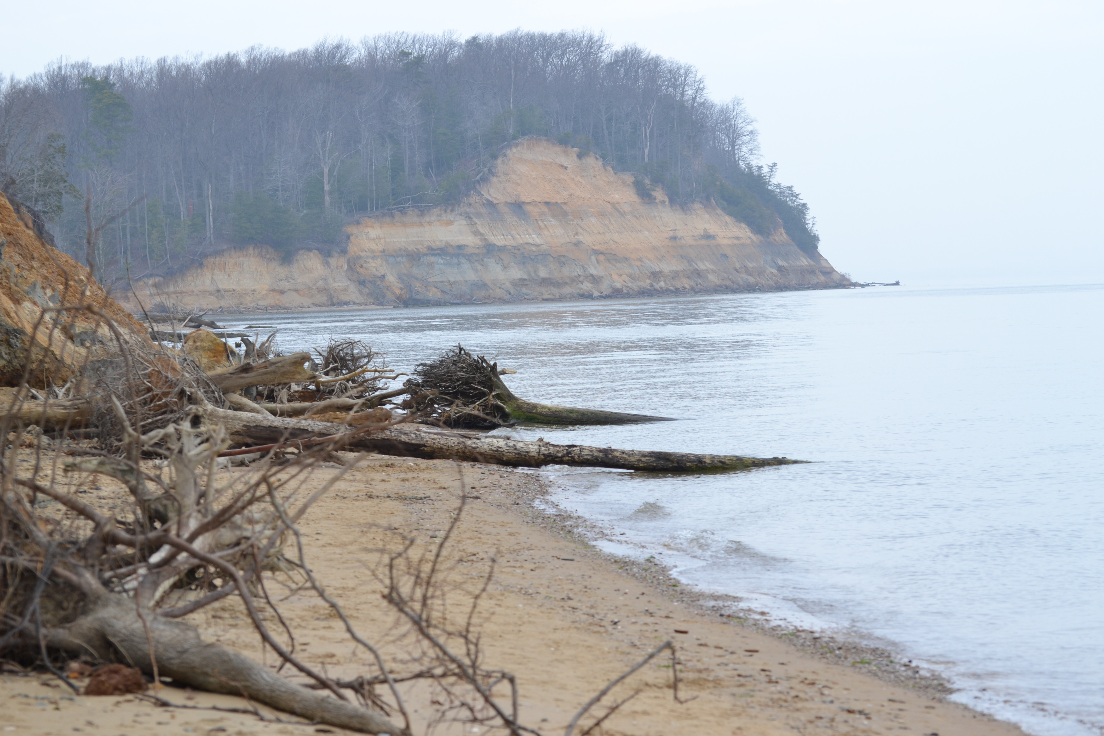
 Out at the beach, we ran into some birders with nice binoculars and telephoto lenses, and they were kind enough to let us use them to see the bufflehead ducks and a couple loons diving out on the Chesapeake Bay. The foghorn had stopped, but it was just hazy enough that the horizon on the bay didn’t exist – sky blended into water, and a northbound container ship appeared to hover. The water was too cold to do much fossil hunting, so we headed back up the Red Trail on the boardwalks along Grays Creek.
Again, birds were plentiful – A couple juvenile red-headed woodpeckers (more! who knew?), mallard ducks, and Canada geese. We saw two beaver lodges about 0.4 miles upstream from the primary dam, but got distracted there by eastern towhees scratching around in the underbrush.
 We had originally planned on using the White Trail to cross north back toward the hunters’ lot, but stayed along the creek until passing the Blue Trail intersection. We then cut north on a spur to the Black Trail (service road), hung a left on Black and then back right onto the Silver Trail. Shortly after that turn, we had a downy woodpecker buzz us and then land nearby begging for a picture.
http://dnr.maryland.gov/publiclands/Pages/southern/calvertcliffs.aspx
Map: http://dnr.maryland.gov/publiclands/Documents/CalvertCliffs_map.pdf

I came to get the other links for the Maryland.gov map and info because I’m a single female and I’m ready to get back into hiking, and was concerned for my safety.
Anyway, the link’s not working, so i reckon I’ll go down to the guard shack and check in before hiking.
Anyways, I looked at you’re bio, and bc you’re my kind of people (I sail, kayak, and I’m a vet), I wanted your opinion. Would you let your wife hike during the daytime without a conceal-carry?
LikeLiked by 1 person
Thanks for the note on the broken link. It appears MD DNR is redesigning their web site and bass moved things around. I’ll update this post accordingly, but map appears to be here, if you cut and paste this into your browser: http://dnr.maryland.gov/publiclands/Documents/CalvertCliffs_map.pdf
As far as your question goes, maybe I tend to underestimate the risk, but yes I feel it’s safe. My wife does, info fact
LikeLike
..continuing, stupid phone! 🙂
My wife does, in fact, do this sort of thing on her own as a photographer. Calvert Cliffs is certainly a safe place, as it’s very popular and populated, lots of families. You would be hard pressed to find yourself alone in a dark alley, so to speak. And you can choose your time windows (weekend, nice weather, etc) to maximize that.
LikeLike
All that aside, I’m glad you’re looking to get back out there. Thanks for reaching out, and I hope what I’m doing here can help!
LikeLike