
Leaving Marymere Falls, we headed back out toward Port Angeles to visit the destination we didn’t have time for the day before – Hurricane Ridge. It’s a commonly visited spot, at the end of the main National Park access road out of Port Angeles, but it’s popular for a reason, and even though it represented a little bit of backtracking for us, I didn’t want to give up the opportunity to visit the subalpine peaks in Olympic. It did not disappoint!

The climb up to Hurricane Ridge is not a long one. In less than 20 miles from sea level in Port Angeles, you climb from temperate rainforest with giant moss-covered trees, up through montane forests to subalpine meadows in only 5,200 feet of vertical change. That’s not really much of a climb – I mean, you’d certainly feel it if you hiked up it – but compared to where you find treeline at lower elevations, or deeper in the Rockies (like in Colorado), it is VERY accessible to reach and be able to hike around at or above treeline at just above 5,000 feet.
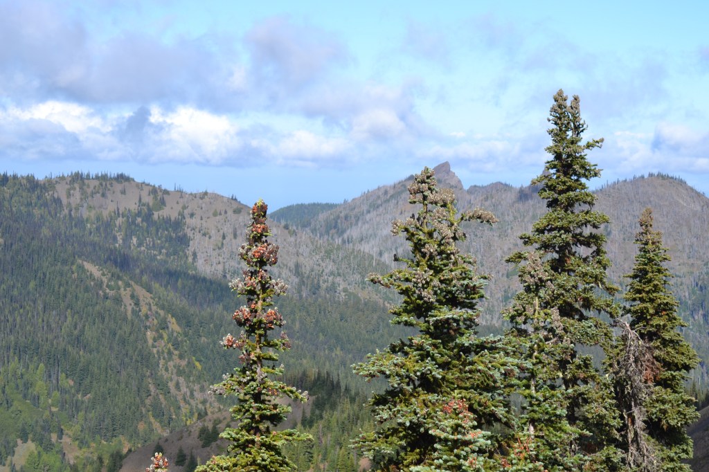
I must admit I expected to be higher. The tallest mountain in Olympic National Park is Mt. Olympus, at 7,972 feet, but even at that low altitude, it is glaciated! There are snow-capped peaks here all year round, and Hurricane Ridge offers an excellent view of the most rugged, rocky, tallest, and snowiest mountains in the park.
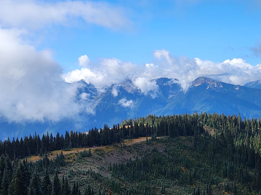
The Visitor’s Center at Hurricane Ridge burned down in 2023, so amenities are currently limited to portable trailers. But the views remain, and when we first pulled into the lot atop Hurricane Ridge, we were awed by the panoramic view of glacier-covered peaks emerging from the dispersing cloud. Depending on where the clouds were, we had on-and-off views of Mt. Olympus and slightly-closer Mount Carrie (6,972 feet).

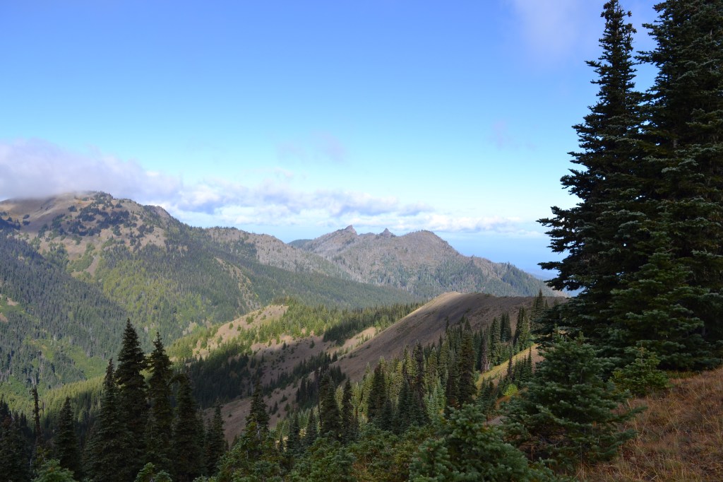
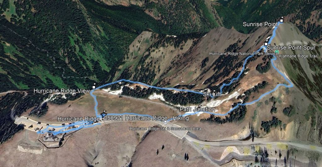
After staring at rocks and glaciers for a while, we took a short hike. Heading north across a meadow from the parking lot toward the ridge-top, you can quickly find yourself with clear views out to Vancouver Island, and to other nearby rocky peaks (Hurricane Hill, Mount Angeles). Ocean in one direction, mountaintop glaciers in the other. We wound up doing a 1.5 loop just in connecting nearby views. Our route turned east and led to the peak at Sunrise Point (about 5,400 feet), and then back via a local peak where ski-lift anchors are mounted.
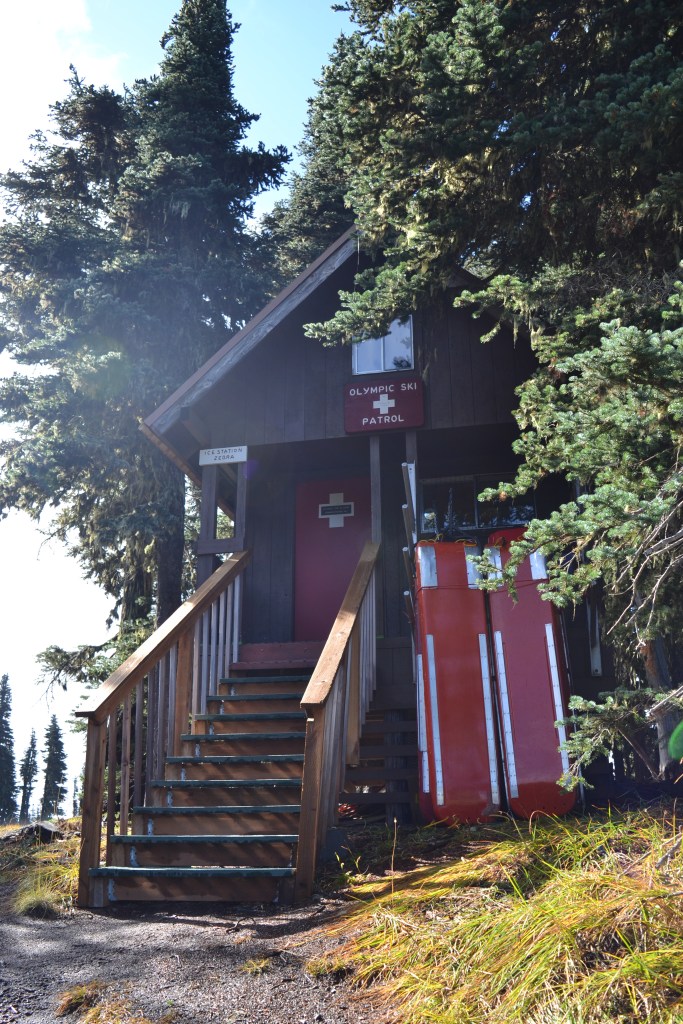
This whole area, including the north-facing bowl below the ridge, is an active ski area starting in mid-December. I thought I was seeing relics of an old ski area, but nope – people ski here. The area gets 400 inches of snow per year, and this little area contains two tow ropes and 800 feet of vertical.
Hurricane Ridge is a beautiful stop, and it offers such contrast from the rainforests below. I think having good weather is essential to the experience – but we lucked out. My wife explained that she’s never had the opportunity to hike in alpine places like this before, so from her perspective, this was a unique, first-time experience. (Again, MUCH easier than walking around at 11,000 feet in Colorado. There’s actually air here!)

Just after noon, we wrapped up and headed back down, back toward Lake Crescent. Our backtrack had certainly been worth it, but now we needed to keep moving east. First, we pulled off at La Poel picnic area along the southern lakeshore, and pulled out our stove to make egg sandwiches for lunch.
Refueled, we headed toward Sol Duc, and then to Rialto Beach. I’ll cover both those next time…
Hurricane Ridge Key Parameters:
Length – 1.5 miles
Ascent – +/- 205 feet
Trailhead – 47.97003, -123.49723
Get Out There

Hurricane Ridge was closed when we visited a couple of years ago in the spring. Glad to see what we were missing. The views of the mountains are gorgeous.
LikeLike
Absolutely gorgeous. My wife had never experienced anything like it!
LikeLiked by 1 person