Dragon’s Tooth is a narrow point of rock that rises above Catawba Valley, in southwest Virginia near Roanoke and Blacksburg. Together with nearby McAfee’s Knob and Tinker Cliffs, it is part of the Triple Crown of scenic spots on the Appalachian Trail (AT) in southwest Virginia.
If you’ve got the time to string together all three viewpoints on a backpacking loop, the Triple Crown can’t be beat – but if you’re interested in a quick (but fairly strenuous) dayhike loop, climbing to Dragon’s Tooth is a great way to spend an afternoon.
The loop we took (myself, my father, and my two sons) started at the Dragon’s Tooth trailhead off VA route 311 in Catawba (37.37846, -80.15604, 1,760 ft). The Dragon’s Tooth Trail is a well-graded trail that climbs steadily, initially up a creek valley, and then up the eastern slope of Cove Mountain to reach the Appalachian Trail at Lost Spectacles Gap (2,440 ft).
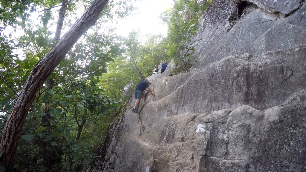
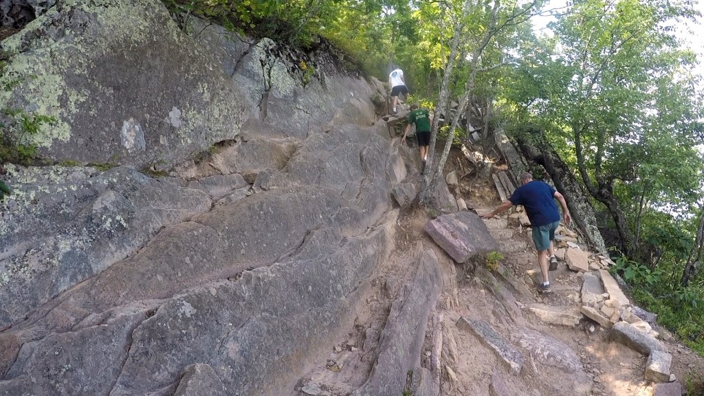

From the gap, the AT climbs along the steep sides of Cove Mountain, using natural fissures in rock faces to provide mostly obvious, but challenging climbs along the slope. Confidence in your footing is a must, and icy or wet weather can make some of these ascents dangerous.
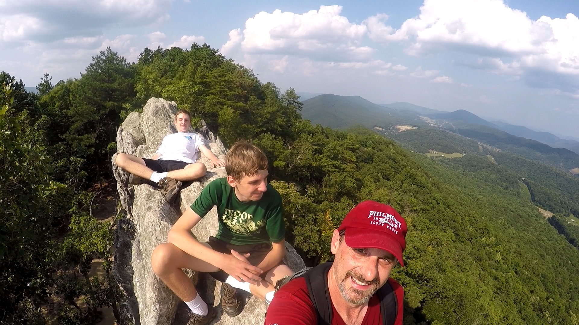
Eventually, you’ll reach the local summit of the ridge of Cove Mountain at 3,025 feet, where a spur trail leads south to Dragon’s Tooth. Following this trail, you’ll descend along the ridgeline to the protruding Tooth itself.
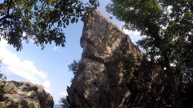
Climbing the Tooth is not for the faint of heart. The rocky spine is very narrow, and there are a few places where clearing gaps poses a fall hazard if you miss your footing or grip. Please use caution if you decide to try and go up the rock – the views are plenty good without climbing to the pinnacle.


From the tooth area, views are predominantly south across Catawba valley, but there are also good views to the northeast, along the ridge that the AT follows up to McAfee Knob and Tinker Cliffs.

On the descent, we chose to follow the AT from Lost Spectacles Gap, to form a more interesting loop. The trail starts with a climb right out of the gap, but then follows a rocky ridgeline with more fun boulder hopping, until reaching an intersection with the Boy Scout Trail. Here, the AT turns southeast to descend and cross Catawba Valley. The Boy Scout Trail leads the other way, northwest to bring you back to the Dragon’s Tooth Trail near the trailhead parking.

Despite its short distance, the Dragon’s Tooth loop is challenging, both for sections of steep trail and for challenging footing in the rock scrambles, but the view on top is worth the effort!
Key Parameters:
Length – 5.0 miles; Dragon’s Tooth Tr to AT, to Tooth Spur; Descend via AT and Boy Scout Tr
Ascent – 2,070 feet; Descent – 2,070 feet
Other Considerations – AT portion of route is rocky and steep, with considerable rock scrambling.
Trailhead – 37.37846, -80.15604


Get Out There

I don’t think I’ve been to Dragon’s Tooth, specifically, but I am familiar with that part of Virginia. It was about 20 years ago. I went hiking and camping there with a friend. We ended up listening to The Lord of the Rings soundtrack a lot, which just felt so utterly perfect for that scenery.
LikeLiked by 1 person
A good soundtrack to make any terrain feel epic!
LikeLiked by 1 person
Sounds like a fun and adventurous hike! I wouldn’t want to attempt it in the rain! Fabulous views from the top.
LikeLike
I did this hike when I was in college and don’t remember it being that rocky / cliffy. Now that I’m older, I kept thinking about how rough it would be in rain or in snow and ice. Heck, even doing it with a backpack (it is the Appalachian Trail, after all) would be a challenge!
LikeLiked by 1 person