If you enjoy hiking (particularly bushwhacking), are good with a topographical map and have a sense of how to correlate terrain features to it, I want to try to encourage you to try competitive orienteering. It’s great fun, and excuse to get out and run through the woods with minimal technology – just a map, compass, and your wits.
No matter where you live, chances are there’s an orienteering club near you. Most put on regular competitive events. My “local” club is the Quantico Orienteering Club out of Northern Virginia, and they do regular events all year round at various parks in the DC area.
You can compete solo, or as a team – working as a team provides multiple brains and sets of eyes to interpret the land around you, but it also generates lots of group discussion that a solo competitor isn’t burdened with. Of course, if you’re solo and you make a mistake, nobody is there to help you catch it. Let’s just say there are pros and cons to both approaches. I like going in a group because it’s just fun to share the hunt.

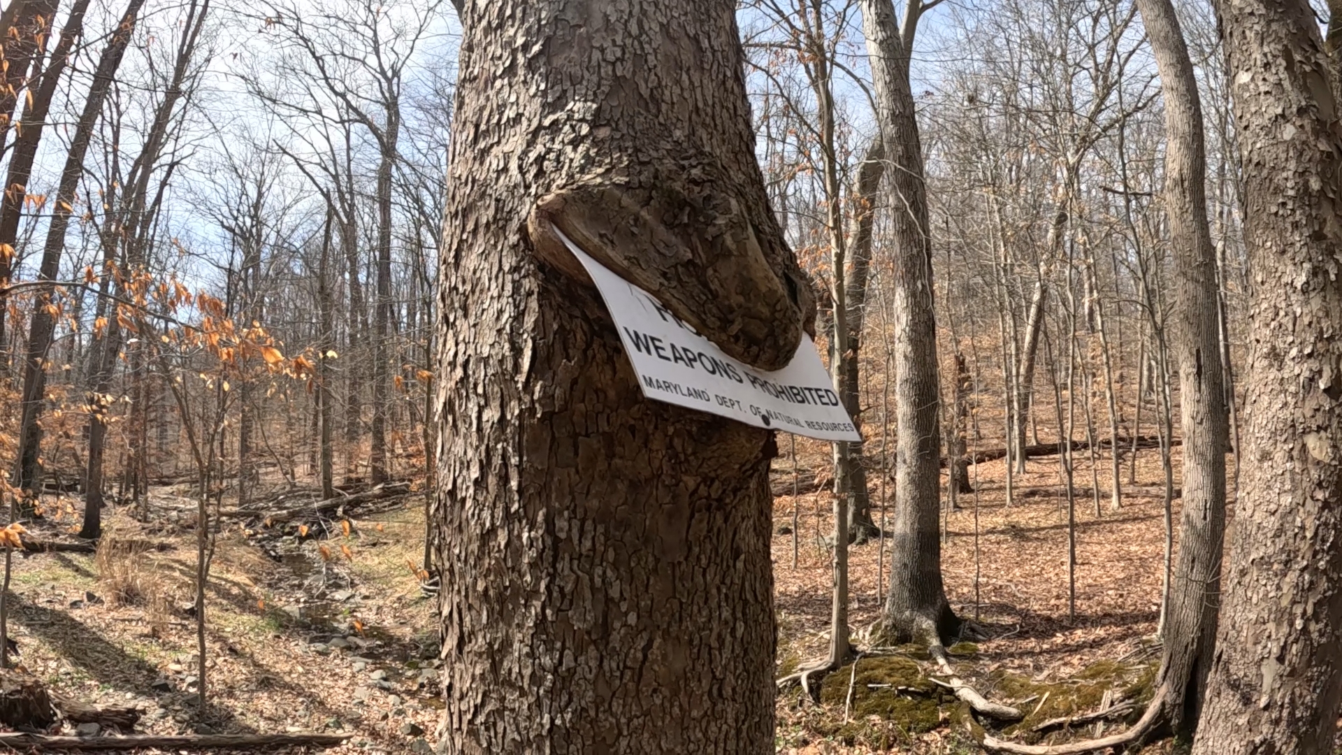
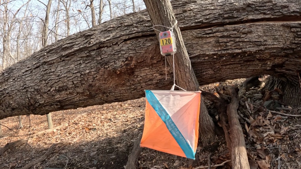
The whole idea with orienteering is to follow a charted course and find a set of “controls”, in order, and (if you’re actually trying to be competitive) do that in the shortest time possible. A “control” is a specific spot, marked by an orange and white flag and (typically) an electronic RF-ID reader that records the presence of your “E-Punch” when inserted into it. Inserting your e-punch, basically a little RF-ID tag the size of a USB thumb drive, records your discovery of the control and marks it with the discovery time. Sequenced together, the e-punch records your overall elapsed time as well as individual lap times between controls.
(A bit of an aside – in the old days, a control had a mechanical hole punch with a particular shape attached to it. When finding a control, you would use that punch to create a hole in your progress card – maybe a star for control 1, a diamond for control 2, etc. This enabled judges to verify that you found the right controls in the right order, by correlating the shape of the punched holes to a key that only they possessed. Thus the modern name for the electronic equivalent – “E-punch”.)
Typical events have multiple courses set up, color coded from beginner (White, Yellow) through intermediate (Orange, Brown) to advanced (Green, Blue, Red). More advanced courses typically have longer legs and a longer overall distance, more off-trail navigation required, and more challenging control placement (e.g. controls hidden from sight from all but one direction). Beginner courses allow for following of trails and easy sightlines.
We recently did this in a group of three on a Green course at Patapsco Park in Baltimore County, MD. This was our first course in the advanced category. It was listed as a 6.9 km (4.3 miles) and 245 m (804 ft) of elevation gain, with 15 controls to be found. We did our best to find trails that made for easier going for most legs, but this course had a lot of off-trail navigation that required literal bushwhacking through thorn bushes.

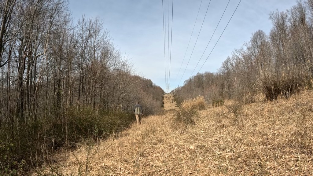
At one point we misread the map and mistook a powerline cut for a road – so hoping we would find a bridge to cross a steep-sided creek gully, we found with disappointment that we’d have to plunge straight down one 200-foot embankment and straight up another. We used the powerline as a handrail, we used a park access road, we followed creek valleys until determining it was time to cut up a hill and search for an orange and white flag.
Controls were tricky too. One was in a shallow hole, invisible until you were right on top of it. Another was hidden among boulders at the edge of a small rocky cliff. Still another was hidden behind the enormous root ball of a fallen tree, arranged so that it was invisible from the direction of approach and could only be seen if you were right on top of it, or had passed it.
The terrain, in addition to the climbs and descents, was rough – lots of downed trees, the aforementioned briar patches, lots of large rocks and unsure footing, and numerous challenging creek crossings.

When we finally cruised to the finish, we had covered 5.7 miles (well more than the straight-line distance) in a little more than 2.5 hours. This put us 29th out of 41 competitors on this course. Not bad for our first try on an advanced run, but we can do better. There’s always next time!
Despite my description of the day as a challenge, it was a lot of fun, with lots of laughs and only some confusion as to where we were (a couple of times). I’d encourage you to search for and participate in a local event if you can. It’s fun, and I understand it’s a good gateway drug into adventure racing as well!
Get Out There


Sounds like a lot of fun and a great way to put your orienteering skills to the test!
LikeLiked by 1 person
The way I was taught orienteering as a kid was very compass-heavy. I’ve learned to spot terrain features instead, and rarely have to pull out the compass to check.
LikeLiked by 1 person
love these images!!
LikeLike
A little like competitive geocaching. But excellent navigation practice!
LikeLiked by 1 person
I’ve never done that, but yes I imagine it’s similar, but without the GPS help.
LikeLike
I imagine there are geocache people who use map and compass only but, when we were doing it, it seemed heavily weighted toward using GPS. Lots of talk on the geocache threads about which GPS unit to get and how to use it, etc.
LikeLiked by 1 person