
It had been a long time since I’d climbed a hill this steep, this high, for this long. My legs reminded me of this inescapable fact with every step I took. As long as I kept my head up and focused on the yellow and red trees, it didn’t matter. My outdoor adventures had been severely curtailed by COVID-related travel restrictions – as they were for many people – and I finally had to take the opportunity to get out into the woods. I could overlook the exertion, as long as I could be in the mountains again.
The Wild Oak is a scenic trail in the Allegheny Mountains of western Virginia, in the George Washington National Forest west of Bridgewater, VA. Depending on where you look, you may find total distances anywhere between 26.5 and 31 miles – A quick web search pulls up 28.2, 30.3 and 27.0 miles, respectively, in the first three returns. And it takes you up, and down, a lot. All of which is to say, plan on a good long weekend, but don’t plan on it being an easy stroll, and you’ll have a great time.
For the record, my GPS told me I walked 30.88 miles, and climbed/descended a total of just over 9,600 ft.

The route takes you up and over three mountains. Working counter-clockwise from the main parking area of FR95 in Stokesville, VA, you can expect to climb steadily to the top of Little Bald Knob (4,351 ft), then plunge down to the North River before climbing all the way back up to the summit of the slightly shorter Big Bald Knob (4,120 ft). From here the trail goes down Dividing Ridge, so named because it separates the Potomac River watershed, to the north, from the James River watershed, to the south, before crossing a low saddle and climbing back up to the summit of Hankey Mountain (3,409 feet) and ending with a long undulating ridge walk back to your starting point.
Aside from the aforementioned Stokesville FR95 lot, there are several side trails into the Ramsey’s Draft Wilderness, an intersection with Braley Pond Road on the west side, and another crossing of FR95 alongside the North River, arranged so that the road essentially bisects the loop. The trail itself is well-marked, with good groomed tread, with only a few rocky sections, the river crossing, and a few steep sections posing any serious challenges to navigation. I’ve seen several reports that the area in the northwest quadrant near the top of Big Bald Knob can get a bit overgrown in summer, due to its intersection with Ramsey’s Draft, and the prohibition of power tools within the Wilderness Area, but during our trek in October we had no problems.
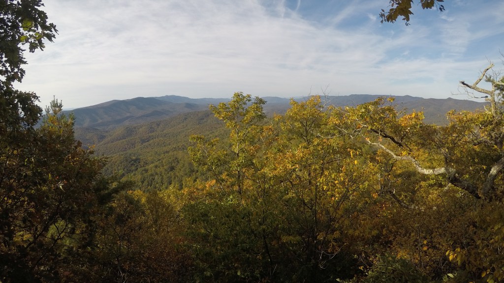
Campsites are plentiful, and free first-come first-serve within the National Forest. Despite the high elevations, views are not plentiful on this trip, as the mountain summits are all wooded, but there are a few nice rock outcroppings, with the best being near the summit of Little Bald facing south across the loop, and then another on Hankey Mountain facing south toward Deerfield and Elliot’s Knob.
Water is the primary challenge on this route. Aside from the one crossing of the North River, there’s really not any to be had without some off-trail excursions. The route is high and, mostly, dry. There is a stagnant pond near Big Bald’s summit, and there is a creek that parallels Dividing Ridge to the north – albeit about 200 feet below the trail. Bring plenty with you, particularly in the heat of summer.
Particulars for our journey:
- LENGTH – 30.88 miles
- ELEVATION CHANGE – +/- 9,640 ft
- DURATION – 3 days, 2 nights
- GPS DATA – Located here
Day 1 (7.1 miles) – Lunch at trailhead, then set off with full water bottles and had a dry camp on the summit of Little Bald Knob, making use of a wide jeep road near the summit to find tenting spots free from the dense laurel.


Wildflowers along the ridge 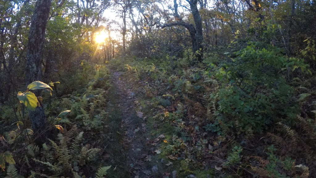
Dawn on Little Bald Knob
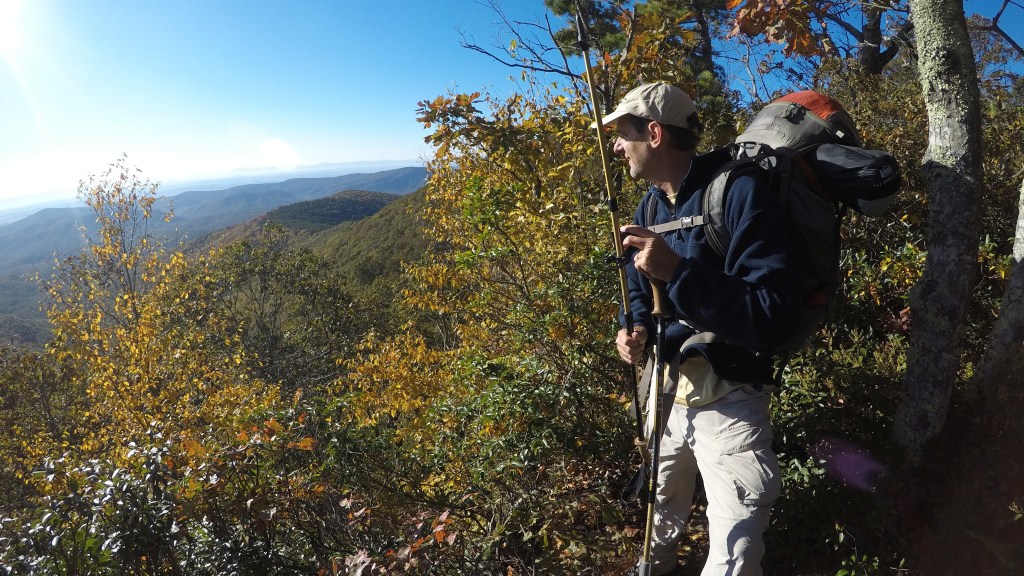
Day 2 (10.8 miles) – Enjoyed an early view from the shoulder of Little Bald Knob, from which we could survey the entire route of the Wild Oak, then dropped 2,000 feet to the North River for our first water access of the trip. The trail crossed FR 95 at Camp Todd here, just beyond the easy rock-hopping river crossing. (At high water, there is a trail detour just upstream that allows you to use the road bridge to cross). After the river, climb 2,000 feet back up to Big Bald, where we stopped for lunch. Then, back down a VERY steep 1,000 feet on the upper part of Dividing Ridge before settling into a mellow easy walk out to Braley Pond Road. We kept expecting that we’d pass near a creek in this section – but though we could see it, and hear it in the valley to our left, we kept going, always expecting a closer option. That didn’t exist… so we wound up having to make a side trip east on Braley Pond Rd until we found a seepy little creek along the roadside. This was water source number 2, our last. Lesson – get water while the getting’s good along Dividing Ridge. It’s your last chance. We set up camp about a mile past the road, short of the final climb up Hankey Mountain, as we were tired and racing daylight after all the day’s ups and downs.


View south from Little Bald Knob. Hankey Mountain runs left-right in the distance. 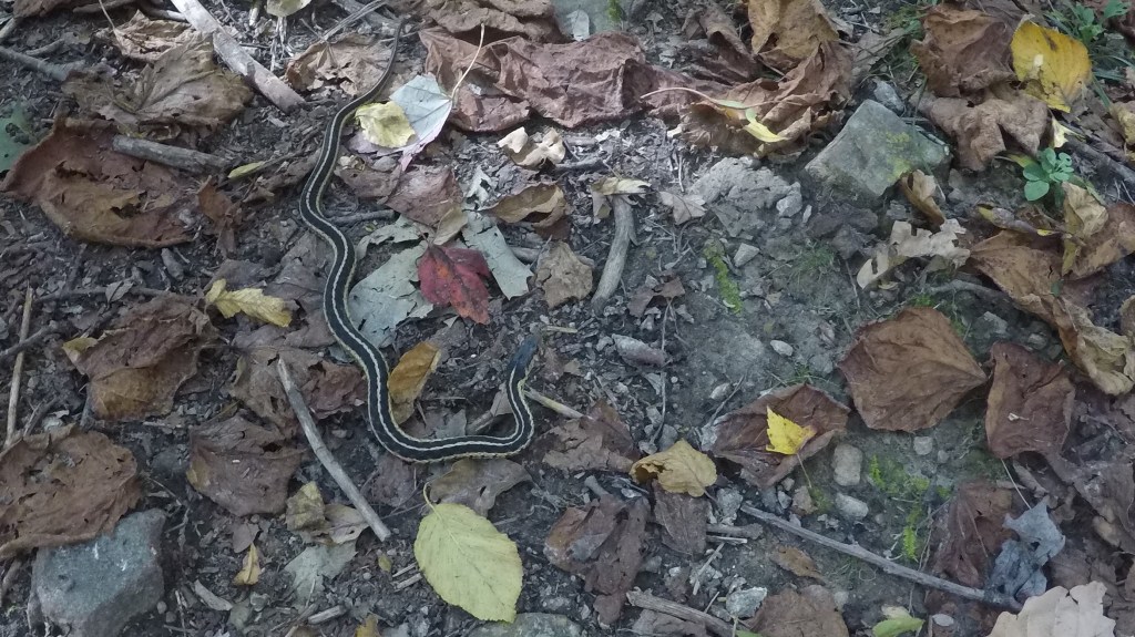
We saw two timber rattlesnakes, and this friendlier garter snake.
Day 3 (11.9 miles) – Make the short but steep climb up onto the ridge of Hankey Mountain, and enjoy a nice view from a rocky outcrop short of the twin summits. From here, it’s generally all downhill, as the trail jumps on and off jeep roads along the ridgeline, making the occasional climb up over local knobs before committing to the final descent back to the parking area. Be warned that just when you think you’ve arrived, the trail doubles back on itself and does some gentle switchbacking, for an unexpected extra mile of travel, to circumvent cliffs that guard the west bank of the North River. Cross the river on a suspension bridge, then back out across FR 95 and back to the parking lot.


Somewhere along Hankey Mountain 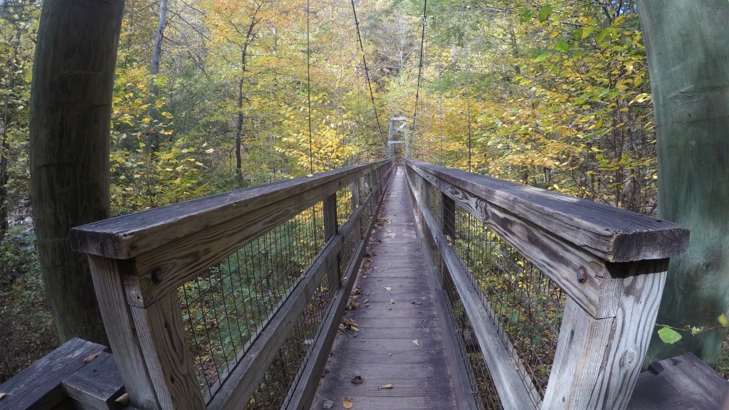
Suspension bridge across the North River (eastern crossing)
GPS data for my trip is available here, and my video synopsis can be found here on YouTube.
Other sources of info:

That looked like a very nice experience. The weather seemed good. Your video added a lot.
LikeLiked by 1 person
Thanks Jim. Can’t tell whether I’m a blogger or a YouTuber. Sort of halfway committed on each, I suppose! 😂
LikeLiked by 1 person