
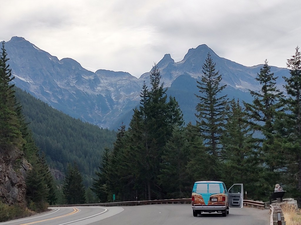
When we last left our heroes, they were at Diablo Lake in North Cascades National Park, marveling at the deep turquoise color in disbelief that it was actually real. By this time, lunch was calling, and so our next objective was to find a good place for that. We were stocked up for one last “brunch” of egg sandwiches, eggs and feta, etc, etc, we just needed a place to cook it.
The problem was – we were completely without any good references to help us find a destination. Yes, I had my phone maps, but I had not preloaded this area, and signal for new data was zero. We had a paper National Park map that we’d been given at the entrance station, but it was disappointingly short of detail. It did indicate the locations of major trailheads, and the presence of several picnic areas, but there were no distance references anywhere that we could find. So we estimated (poorly, as it turned out), and continued east through the park with an eye on either Rainy Pass or Washington Pass.
The road here basically climbs a long single valley, following Granite Creek for miles between rugged ridges. The shape of the terrain suggests that a glacier filled this valley long ago – it’s marked by a fairly symmetric U-shaped curve up to steep and rocky peaks that managed to stay above the scouring ice. Every now and again, we’d catch a glimpse of ice and snow on a glaciated peak. There weren’t many people around, until we passed one of the few trailheads, where suddenly the cars were everywhere, overflowing the parking lots and parked along the shoulders.
This was particularly true at Rainy Pass. The entire population of the park seemed to have converged on this trailhead, which we noted was the primary access to the Pacific Crest Trail in these parts. Given the people, we opted to press on to Washington Pass, and my wife said that’s what she had preferred to do anyway.
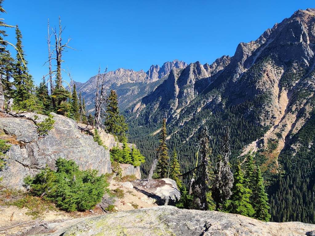
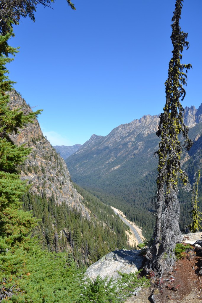
Washington Pass marks a sharp bend in the road, where the road tops out in one valley at about 5500 feet and starts to descend another. There’s a dedicated picnic area here, meaning it’s not an aside to a trailhead, but just a spot to pull over and have lunch. There is, however, about a half-mile loop out to a viewpoint over the Early Winters Valley, with Hinkhouse Peak to the north and the impressive spire of Liberty Bell Mountain to the south.
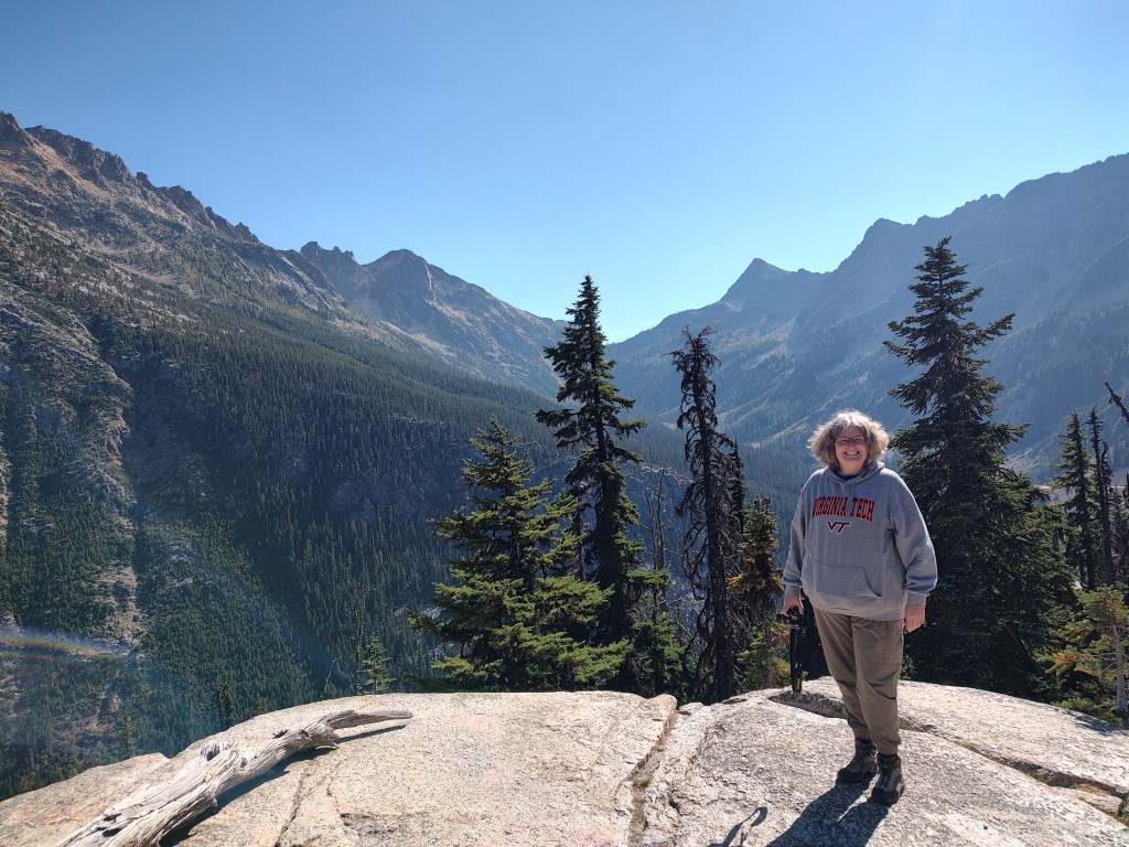
We opted to walk first, and it was gorgeous. The view-to-effort ratio is extremely high, with big payoff for just a little heavy breathing brought on by still being a flatlander above 5,000 feet.
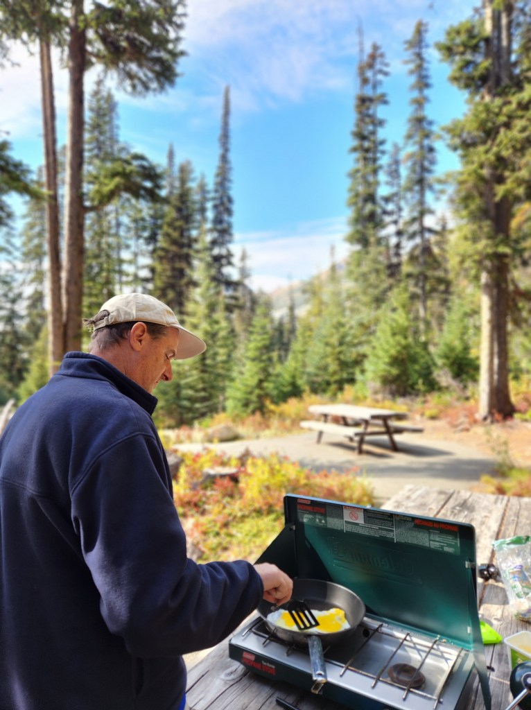
Following the quick walk, we made our way to one of the several picnic areas and set up for lunch, where we ate pretty much everything we had left. I was challenged to cook up the rest of our spinach, which I did, with some butter and garlic. At this point we were down to just spices, oil, butter and some balsamic vinegar. Bittersweet. But cooking and eating outside in a beautiful spot like this is hard to beat!
Following lunch, we backtracked and made another quick stop at Diablo (discussed during my last post) on our way back out of the National Park and southward to Darrington, where we enjoyed getting a look at all the mountains that were obscured by fog on the way in this morning. We had identified a hiking spot we wanted to check out in the Mt. Baker-Snoqualmie National Forest, along the mostly dirt and gravel Mountain Loop Highway that looped through the mountains from Darrington over to Granite Falls. With the gathering clouds and the advancing hour we realized we were going to be racing sunset to get there and complete our hike, but this was our last day out in the mountains and we were ready to squeeze every drop out of it.
After filling up with gas and grabbing a snack in Darrington, we headed out on the Mountain Loop, which quickly turned to dirt and created an instant sense of trepidation. Bones was pretty rugged, but its old suspension creaked over every pothole and we shook everything loose over every washboard. We really had no doubts we’d have trouble getting all the way through, as it wasn’t muddy, the road was generally in good condition, but the road was narrow enough that the occasional meeting of other vehicles was dicey, and every mile became another mile we’d have to backtrack if we came across a downed tree or some other un-passable obstacle. It was great fun!
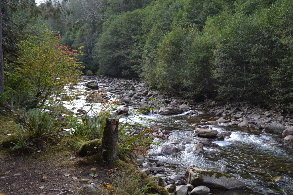
There was one particular stretch where the road paralleled the Sauk River, headed upstream. The river itself wasn’t much wider than a two-lane road, and it babbled happily over rocks and down occasional cascades. All along this stretch, various wide pullouts and make-shift parking spots were variously used by small RVs, trailers, and tents. You’d have to be willing to be fully off grid (including dealing with a lack of restroom facilities), but this stretch was a really appealing place to just pull over and camp.
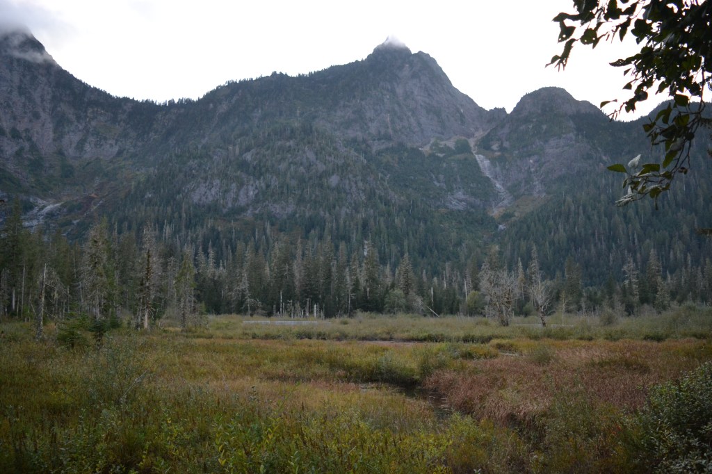
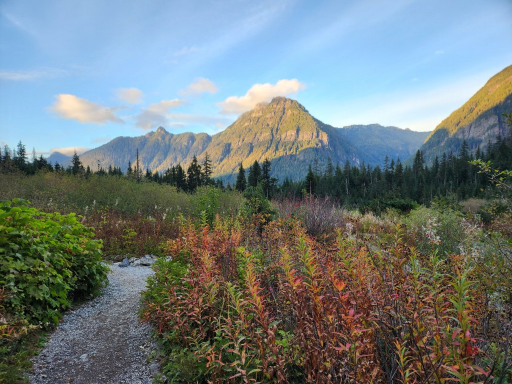
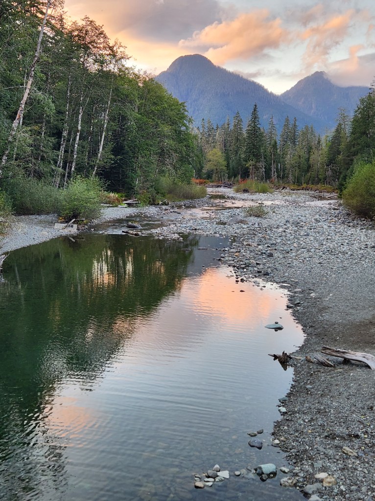
Eventually we made it back to pavement at Barlow Pass, and then shortly thereafter we reached the Ice Caves trailhead with about an hour and a half left before sunset. Ours was the only vehicle in the parking lot, and we’d have the area to ourselves. The trail here is about a 3 mile out and back (we took a slight variation on the way back which may have added a tenth or two). The first quarter mile is level, maybe even downhill, through mature forest to an impressive bridge crossing the South Fork of the Stillaguamish, the very same river we camped next to at River Meadows last night! From there, the trail climbs steadily up through dense forest toward an impressive set of cliffs on the north face of Big Four Mountain.
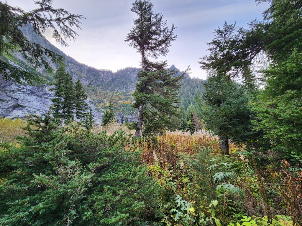
Just by looking at the terrain, it wasn’t really clear where our destination lay, but as we moved up the hill it was clear that we were going to walk right up to the foot of these cliffs. After about 250 feet of climb, the trail leveled and moved through an area of brush and young trees and over gravel. The land became an elevated wetland of sorts, as we traversed through limited visibility over a pile of rock that had clearly fallen off the cliffs above. The vegetation actually gave me a bit of a concern, and I startled my wife by calling out, “Hey, Bear!” just to stay on the safe side. We didn’t see any threatening wildlife, but I was on edge here given the sudden drop in visibility.
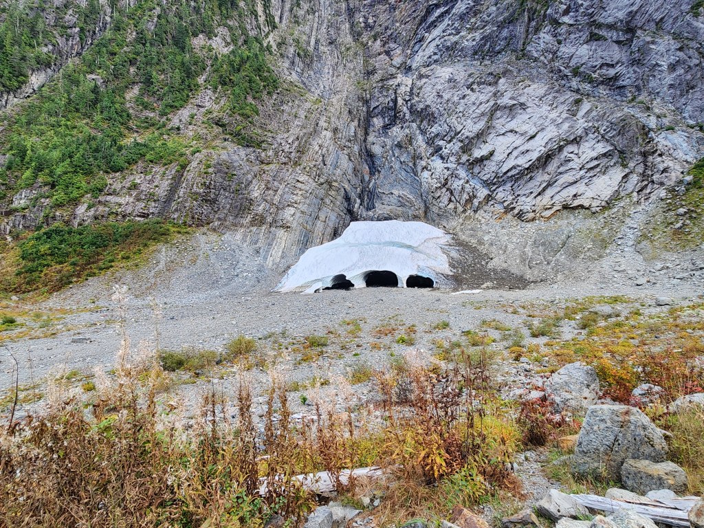
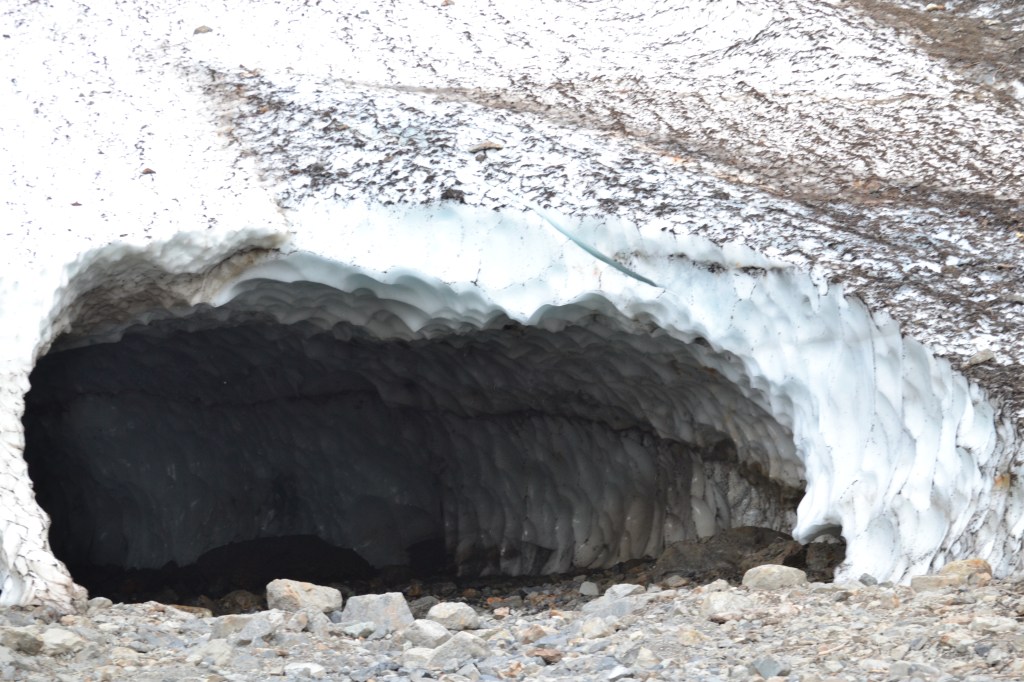
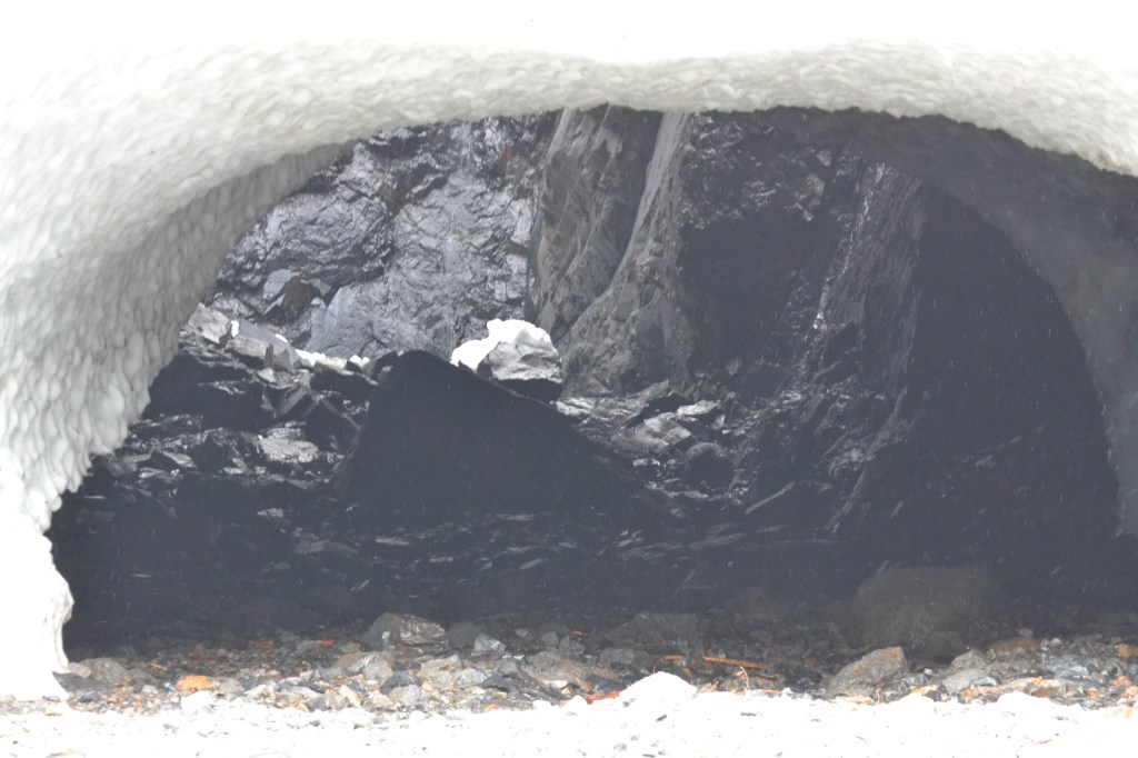
After a short passage through the underbrush, we emerged into a rocky scree field facing the cliff. There at the bottom of the cliff – in late September – was an enormous pile of snow and ice with several subway-sized tunnels carved into it. This time of year, the ice and caves are at their smallest, but in a week or so, they’ll start to grow again.
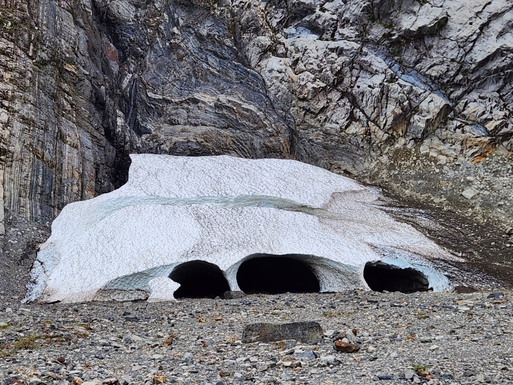
Basically what happens here is that the snow that piles up on Big Four, above the cliffs here, consistently and repeatedly avalanches down, and the slopes above what amounts to a little cirque here tend to focus all that snow into one area, piling it higher and higher. Meanwhile, any meltwater (from spring onward) tends to flow down the cliff and behind the resulting snow pile, melting and eroding the snow away to form these extensive caves.
In reality, this is a pretty dangerous place. Hazards include: Falling snow (not concerning at this time), falling rocks (quite possible), and collapsing caves. Several signs are posted around warning that people die here trying to get too close. We had no intention of being crazy enough to go into the caves, but we established what we thought would be a safe distance away in case of a collapse, and moved forward to that point, still about 100 feet away from the ice. (Interestingly, when we looked at our GPS track later on Google Earth, the spot where we stopped was inside the snowfield based on photos taken in July!)
The ice was impressive, and we felt very small here. The cliffs encircled us, and a lonely raven flew within the cirque, croaking warnings at us while also giving a sense of scale, and making us realize these cliffs were even higher than they appeared. Occasionally, we’d here a loud, echoing BOOM! from the ice. Something was cracking. It sounded very much like a glacier calving, although we couldn’t see anything falling. We kept waiting with perverse curiosity, hoping that something would let go. I can’t imagine we were just lucky… I have to suppose that the ice is slowly collapsing and making a lot of noise about it pretty much all the time.
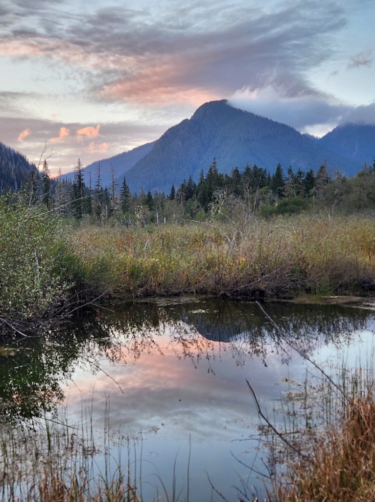
Eventually, we had to turn around and head back down. The sun was setting, and though we couldn’t see it directly because we were in the shadow of the cliffs, the mountains across the valley started to show alpenglow. My wife joked that it was a shame our views on the walk back would be so drab and boring!
As it turned out, we hit the sunset jackpot. The clouds were dramatic, the surrounding peaks were red-gold in the sunset glow. The Stillaguamish reflected the pinks and reds of the darkening sky. And instead of walking back the same way we’d come, we elected to take the boardwalk out through the marsh adjacent to the old site of the Big Four Inn that used to stand here. The walk out into the wetland turned out to be a great choice, as it offered even better, unobstructed views of the mountains illuminated by sunset. A beautiful way to end the outdoor portion of this entire journey.
Ice Caves Trail Key Parameters:
Length – 3 miles, out and back
Ascent – +/- 250 feet
Trailhead – 48.06606, -121.51066
From here, we made our way west in the dark, headed back toward Seattle. We had one more day (and at least another post!) left on this trip, focused on being regular tourists in downtown Seattle. Tonight and tomorrow night, we’d stay at a hotel near SEATAC airport, and early tomorrow morning we were scheduled to take Bones back to its home base. It had served us well, creating a mobile home away from home and allowing us to move through some of the best parts of the state without having to hub-and-spoke our journey back to civilization every night.

For now, we stopped at a Mexican restaurant in Lake Stevens and enjoyed good spicy food that somebody else cooked, and then we cleaned out Bones and repacked our gear at the hotel, preparing it for its return. It would be hard to say goodbye!
Get Out There

Beautiful scenery. The ice caves look neat. Looks like you picked a good spot to eat your last lunch. I imagine it was tough to pack up and head back home.
LikeLiked by 1 person
I was surprised to see so much snow down low in late September (essentially the time when snowpack should be at a minimum). It was a neat place. And yes, going home was bittersweet at this point!
LikeLike