
Having spent the morning hiking around and getting various views of Rainier, we had worked up an appetite, so we popped over the ridge, just downhill from Paradise, to the Paradise Picnic Area. This was very conveniently placed for us, though it put us among the trees and out of sight of the summit.

As we cooked our eggs (we’ll call it brunch), we talked about the glaciers, the snowpack, and pictured what the area would look like later in the year. I’ve already mentioned that most campgrounds had closed two days before we were here, and Stevens Canyon Road, our planned route east off Rainier, would be closed soon. It was hard to believe winter was coming, given how beautiful it was, but we really were lucky – it actually turned out that two weeks after we were there, the Paradise area got its first significant snowfall of the season.
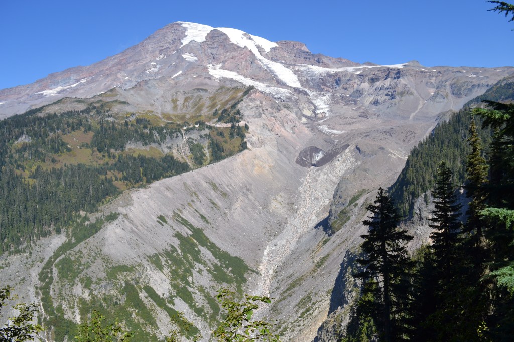
Also, after musing in my last post about the retreat of Nisqually Glacier up the valley, I did some digging for historical photos and wanted to revisit that, briefly. Turns out that back in the 1850s (the “Little Ice Age”) the glacier had extended all the way down to below the current bridge across the Nisqually River, but had retreated 1.2 miles and out of sight of the road by the 1950s. It saw some slight growth for a few decades, but then kept retreating after the 80s. It has retreated almost 2.5 miles in the last 100 years. To help visualize that, here’s a picture taken in 1922, compared to our view.

While we ate, we also were visited by more Canada Jays. About five of them hopped around and begged, and did everything but land on the picnic table and grab our lunches directly. I learned from iNaturalist that one of the nicknames for these jays is “Camp Robber”, and I can see how they might have gotten that name.

Leaving the picnic area, we continued back down the road to Narada Falls. We had taken note of the large parking lot on our way up to secure a spot at Paradise, and reasoned that meant it was popular, and probably accessible. In other words, easy to get to, and impressive to see. We were half right. The river passes right by the parking lot, and then plunges sideways over a cliff into the valley. On the parking lot side of the valley, though, Narada Falls is a tease – you can see the river vanish over the precipice, and you get a sense of how big the drop must be… but in order to see it you need to cross the river and descend to a viewpoint on the other side.

Having been suitably enticed, we committed to make the descent, even though we were still tired from the morning’s walks. It was definitely worth it! Being glacier-fed, the flow was significant even in late September, and our timing was such that the sun cast a nice ephemeral rainbow in the mist of the falls about halfway down its drop. While we enjoyed the view, a hiker showed up from downhill, having walked up from Cougar Rock Campground. He also agreed it was worth the effort, even though he had expended a lot more energy than we had.

I took the opportunity here to make a little solo side trip downhill a bit myself. I have long wanted to get a permit and time to go thru-hike (circumnavi-hike?) the Wonderland Trail, a 93-mile route that circles Mt. Rainier at an average of about 5,000 feet elevation. Standing here at Narada Falls, I realized I was only about 100 yards from the Wonderland, so I had to hop down and take my first steps on it. Some day…
Leaving Narada Falls, we jumped back in Bones and headed back up to Paradise to drive out via the Valley Road. We noted that the crowds had increased significantly since we left – cars were parked on the shoulder down Valley Road at least a half mile past Paradise. We were glad we’d arrived early.
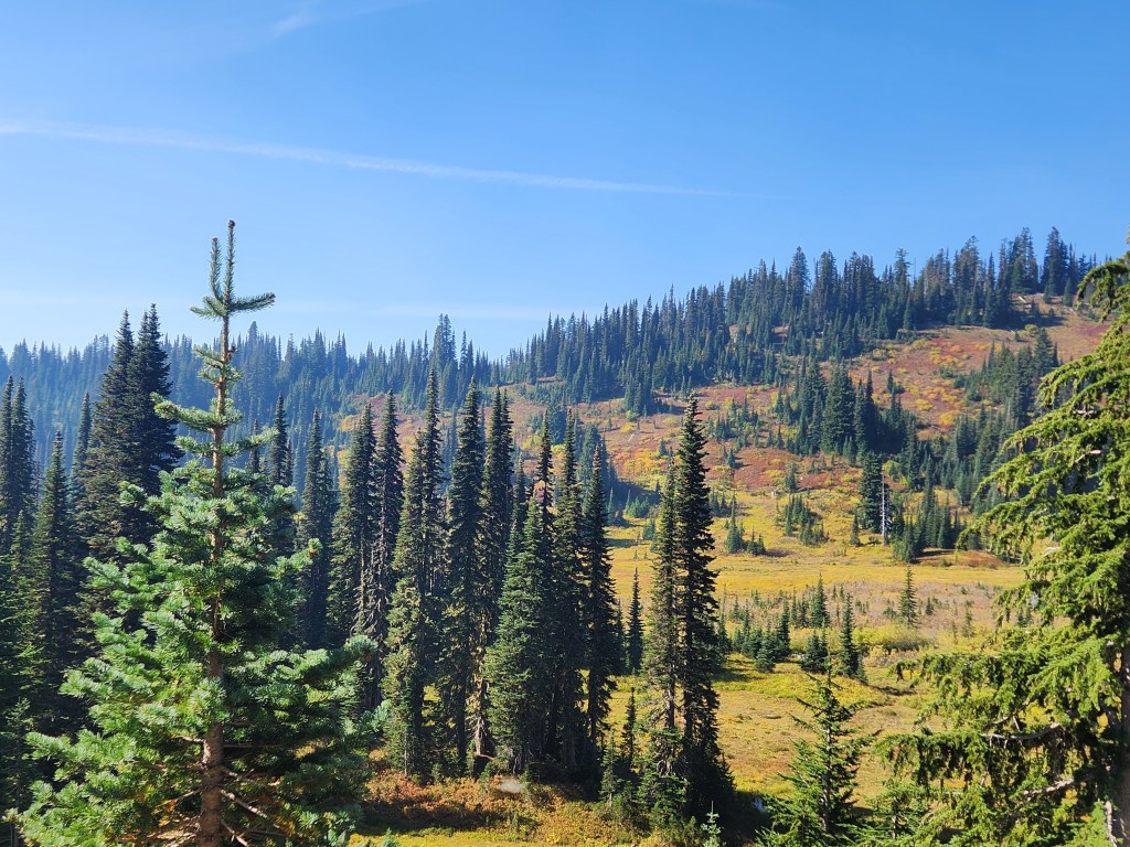
Paradise Valley itself is a beautiful high alpine meadow encircled with various conifers. It would have been the ideal spot to see a herd of elk, or a bear, but we were not so lucky to see any large wildlife. We were also on the lookout for marmots or pikas, but didn’t see any of those either. Even without the wildlife, the valley was beautiful, particularly since it was tinged with fall color. I couldn’t help but picture it full of snow, and with that filter applied I could envision it very much like a “bowl” ski area somewhere in Colorado.
Shortly after passing the valley, we joined Stevens Canyon Road and turned left to head east off the mountain. We made a quick stop at Reflection Lakes, a spot where the summit of Mt. Rainier is nicely mirrored in the still waters and creating some great photo opportunities. Unfortunately a light breeze had started up and drove ripples across the lake, ruining any chance of a clear reflection. It was still a pretty area, and we got out and walked some more. Turns out, the trail along the Lakes here is ALSO part of the Wonderland Trail, so my wife has now hiked part of it too!

This was our last real stop in Rainier, proper. We continued on down Stevens Canyon Road and enjoyed views of the steep-walled valley, but noted that the farther east we went, the more the air was filled with smoke. This was the result of the Wildcat Fire, burning about 8,000 acres (at the time) in an area east of Rainier. We had noted this fire before we ever left home, because some of our possible hiking destinations, like Naches peak, were closed because of fire activity. We also recognized that we’d essentially have to drive around it, and that tonight’s campground might be affected by smoke in the air. At this particular moment, the light wind was from the east, blowing smoke away from camp and toward Rainier. (At the time I’m writing this, about a month later, the Wildcat Fire is still active, has roughly doubled in size to 15,500 acres, and is still only 5% contained).

From the east end of Stevens Canyon, Rt 123 was closed to the north for pre-snow repairs, so we had to head south and east toward Rimrock Lake and Naches. Coming down out of the mountains, we passed a small lake with a dam (Dog Lake) and then passed a sign advertising Clear Creek Falls as the valley opened up before us. We kept going, but my wife turned around in her seat to look back and told me, “We need to go back, that’s a significant waterfall.” So, we did! Clear Creek Falls tumbles through a narrow, steep canyon, so it’s a little challenging to get to a spot where you can see the whole drop, but the falls, and the noise of the water echoing off the canyon walls, are impressive. I’m glad we’d turned around and made the stop.
Descending into the Rimrock Lake area, we found more closed roads, and got detoured onto State Forest roads around the south end of the lake. The lake itself was VERY low. Not completely dry, but clearly a shadow of its former self. Obvious “islands” in the lake were little clusters of green surrounded by tan mud flats dotted with tree stumps. At one point, we had tried to book a lake-front campsite on the north side of the lake, but couldn’t work things out with the proprietor. I’m sure it would have been fine, but now that we saw the lake I feel like we were fated to find a better spot – which we had.
We were surprised to see we’d entered a whole new ecosystem here. We’d gone far east enough to get into the arid portion of central Washington. It wasn’t quite desert, but the dark green of the evergreen trees had given way to beige grasslands, exposed rock, and spotty shrubby cover instead of trees. Those trees that were present were no longer spruce, hemlock and fir, but were now largely Ponderosa pine. It was completely different, and it had happened fairly quickly.
Our ultimate destination for the night was Elk Ridge Campground, north up 410, up the Naches River from the town of Naches. As had been the case at Elkamp, there were only a couple other tenants for the night, and we were given the opportunity to take any unoccupied spot we wanted, as we were the last to arrive for the night. We had planned to stay by the river, but our reserved spot was right next to one of the only other guests, and so both because it was neighborly AND because the WiFi connection was better elsewhere, we moved away from the river to be a little more isolated. I’m not ashamed to say network connectivity was part of the decision process here – we needed to do some planning for tomorrow, a mostly travel day that would take us through, or near Seattle on our way up to the North Cascades.
What to do, what to do… We’d do some browsing and figure it out, but we had all the freedom to go anywhere in Bones, so long as we ultimately wound up at our next campsite in Arlington. We would have all day to get there.
Get Out There

Great shots! Looks like a very nice trip taken without too many crowds. I really appreciated you finding the info and old photo of the glacier.
We call Canadian Jays Whiskey Jacks and Camp Robbers. They will take the sandwich right out of your hand.
Really enjoyed reading your report.
LikeLike