The Hoh Rainforest gets an average of 140 inches of rain every year. That’s more than 3 times as much as stereotypically rainy Seattle, only 100 miles away, gets. The Olympic Range catches all the moisture coming in off the Pacific and dumps it onto the westward slopes, generating the famous temperate rainforests, of which the Hoh is probably the most famous.
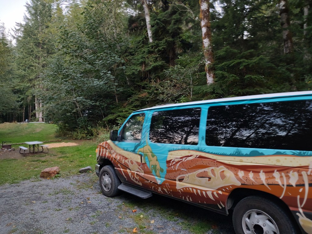
We got lucky. It was clear, dry, and lovely the day we planned to visit – Day 3 of our campervan journey around western Washington.
At this point in our journey, I felt like I had seen enough of the rainforests of the Olympic peninsula. Maybe we had overstayed our time in Olympic and needed to move on. But we had been looking forward to the Hoh, and had time on the itinerary to get there… so we left Mora Campground on a mission to get there before the crowds did.
Hoh Rainforest is another area where we continuously see warnings about overflowing parking lots, no room, etc. Honestly, we had felt people-saturated at Sol Duc, so we were hoping for the best. The Hoh entrance station has signs up warning that access to the valley is metered – meaning once it fills up, they won’t let anybody get in until somebody comes OUT. I like this approach, as aside from preventing damage and impact, it also is a quick indicator of whether we could (theoretically) get a parking spot and actually enjoy the area.
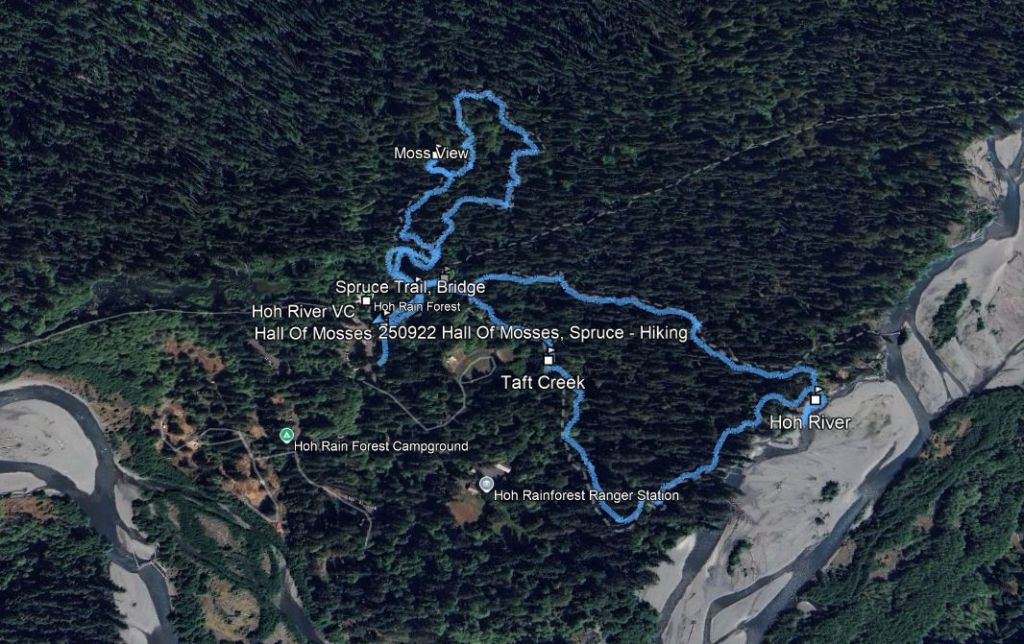
We did get through the entrance gate without any problems (this would be a very short post if not), and made our way to the Visitor’s Center at the end of the road, with a plan to hike both the Hall of Mosses and the Spruce Nature Trails, a combined 2.3 miles that would get us up into the dense forest at the foot of the mountains, and back down to the shore of the Hoh River itself. We made a quick stop at the Visitor’s Center and headed out.

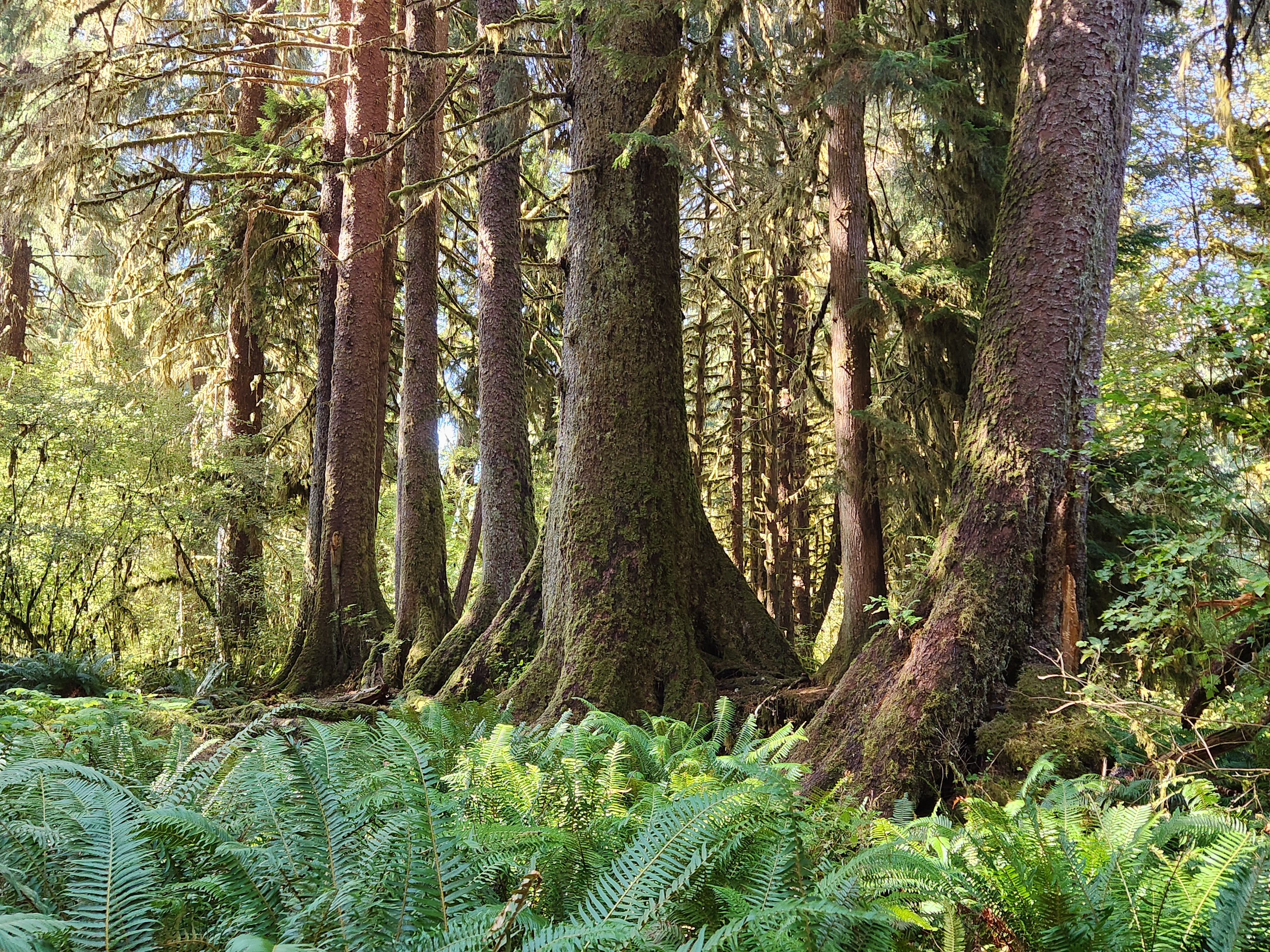
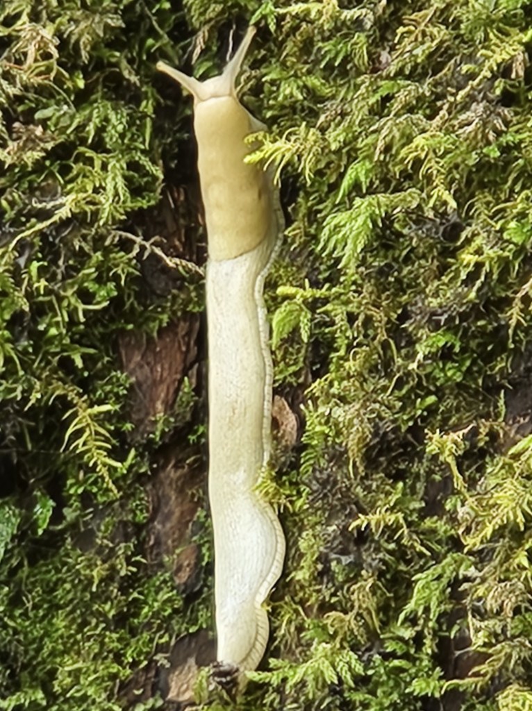
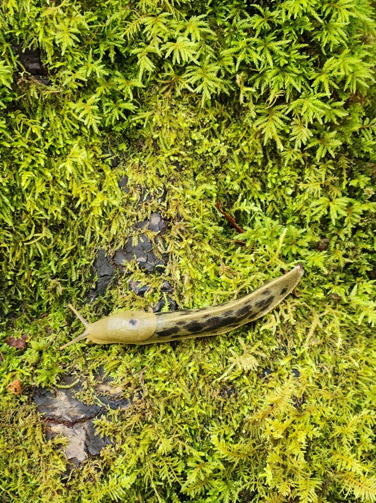
I was wrong to feel like we’d seen enough. If you take all the large trees, the club mosses, the fern understory, and crank it up way beyond eleven, you get the Hoh. There were areas here where the trees were not visible because they were completely covered with moss. Every branch was merely a framework for mosses, lorded over by 8-inch banana slugs. The trees, while still impressive, take a backseat here, at least on the surface.
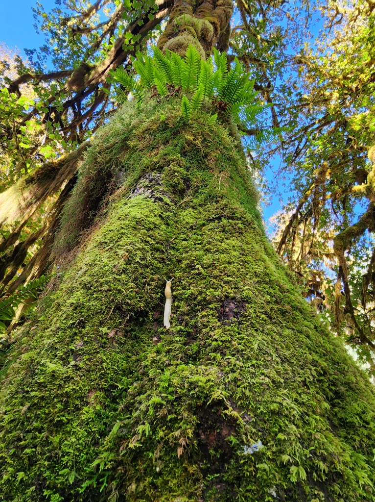
As an example, we learned about nursery logs. Every surface here seems to be covered with vegetation. The ground is full of ferns and low shrubs, but the elevated surfaces here – downed trees, rocks, stumps and root balls of fallen trees – are covered with young saplings. As it turns out, these elevated surfaces are the ONLY locations where saplings can grab a foothold. Down among the ferns, there’s no light and too much competition. But when a giant spruce, hemlock or fir tree goes down, suddenly there’s an elevated perch with deep channeled bark in which a sapling can establish a footing.

As these trees grow, and their roots reach around the fallen log to reach the ground, they grow quickly enough to dominate their neighbors and shoot up. As a result, you get perfectly straight rows of enormous trees of varying species – a tell-tale sign they grew together on a nursery log.
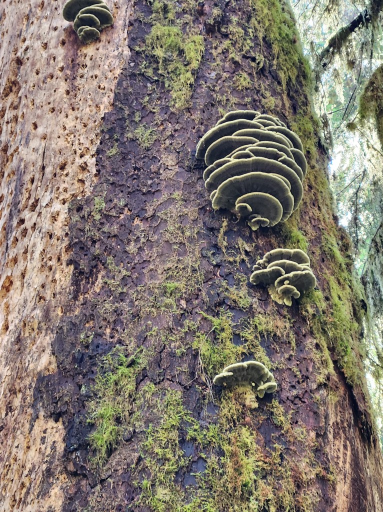
In a similar fashion, we saw clustered trees that seemed to share a main trunk stem before splitting into individual trees – in some cases, these individuals were clearly different species, sharing a trunk? This happens when saplings grow on top of a tree stump, and send root runners around the dead stump and down to the ground. Those trees that win out thicken and smash together, eventually consuming the original nursery stump deep within the new growth.

These are the kinds of weird things that happen to trees when there is no room on the forest floor.
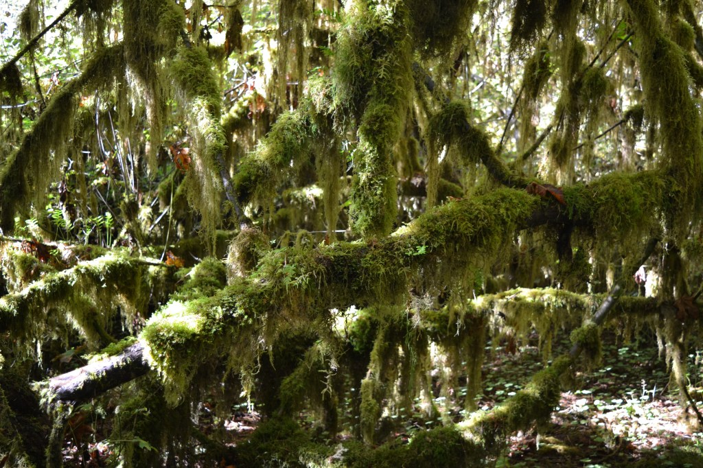
But trees aside, the mosses are the star. In fact, the Hall of Mosses Trail includes a side trail over to a viewpoint that is simply a gallery view of an open section of forest, FULL of green and yellow moss.
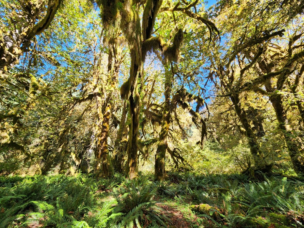
Leaving the Hall of Mosses, the Spruce Nature Trail heads downslope toward the river. The underbrush is just as thick, but as you get closer to the river, rocks become more plentiful and trees become more thinly distributed. The reason? Floods. With 140 inches of rain, on top of seasonal snowmelt, the Hoh River and others like it rises and lowers, meanders, changes course, and alternately scours river banks and deposits glacial silt as it makes its braided way downstream. This makes life near the riverbanks a little more precarious for young trees.
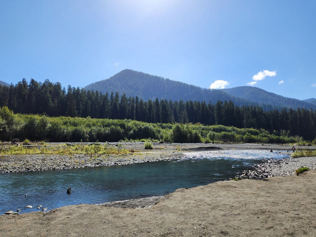
The riverbank along the Hoh River is a contrast to the rainforest itself, and the river makes for a peaceful, beautiful spot to rest a while.
We really enjoyed our brief visit to the Hoh Rainforest. It is different enough from the environment on the north side of the peninsula that it’s worth a stop even if you feel like you’ve seen enough rainforest!
Hall of Mosses, Spruce Nature Trail Key Parameters:
Length – 2.3 miles
Ascent – +/- 200 feet
Trailhead – 47.86048, -123.93427
Leaving the Hoh Rainforest, we started to transition away from Olympic, and over toward Mt. Rainier, our second National Park of the trip. We would need to spend a few afternoon hours, and we’d need a minor resupply to keep our food stocks going for another couple days.
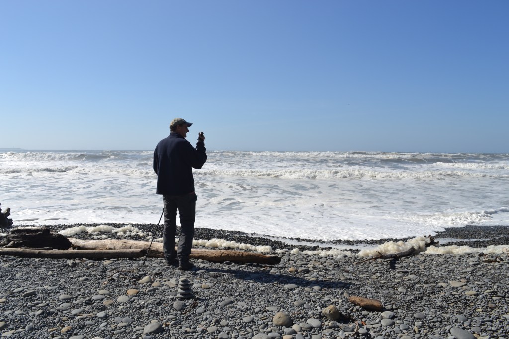
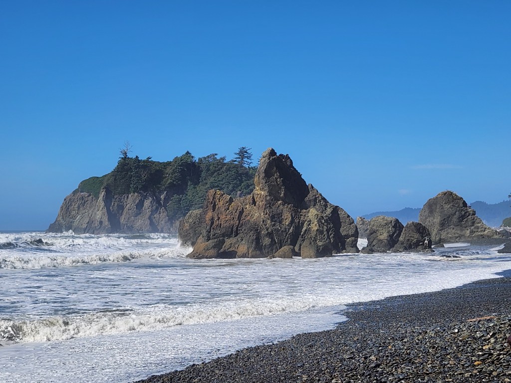
In order to get out of Olympic National Park from the Hoh, however, US 101 has to go south and east around the mountains, so it only makes sense to make at least one more stop by the beach.
Ruby Beach is a good such stop. It’s on the way, accessible, and has striking views of impressive sea stacks. It’s also covered with large pieces of driftwood (whole trees, really), which tangle together to make a natural obstacle to travel or jungle gym, depending on your age and state of mind.
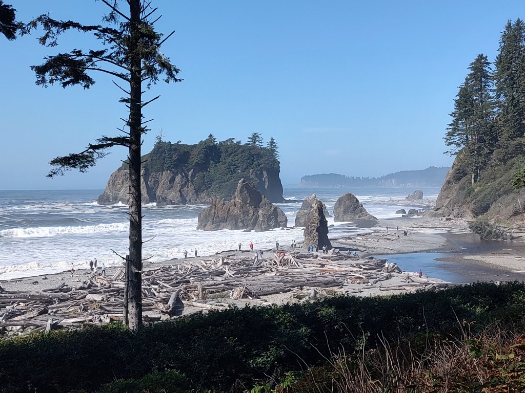
Ruby was a great stop – and a popular one. We lingered for a while trying to catch pictures of the waves crashing against the stacks, and watching judgmental seagulls stand atop rock pinnacles and examine all the people below. We also had the opportunity to watch a fair number of people finding creative routes through over and around the stacks of driftwood.
Beach days must come to an end, however, so eventually we climbed back aboard the campervan and headed east. We cut back east toward Rainier and enjoyed the transition out of the Olympic mountains. For some reason (it was a Monday?) it appeared that EVERY bridge on the Olympic peninsula was under construction. Each one was down to just one lane, with long waits at many of them. We presumed that road crews were racing time, trying to get everything done before snow season. But hey, we didn’t really have anywhere to be, so long as we got to our new campground at a reasonable time.
Somewhere near Olympia, we stopped at a grocery store and fueled up Bones. Soon thereafter we started to see Mt. Rainier on the horizon to the east, while simultaneously seeing Mount St. Helens to the south. I didn’t expect we’d be close enough to see St. Helens – but then again I didn’t expect us to have weather this good. I didn’t appreciate how generally flat this section of the state is. The large shield volcanoes rising up out of the otherwise flat(ish) plains are all the more striking because they stand alone and isolated.
When I was planning the logistics of this trip, I found that today (Monday, Sept 22) was the first day of snow season anywhere near our eastern destinations. This meant that all the reservable camping spots at state parks, state forests, and National Parks were no longer available, closed for the season. First-come, first-serve sites were generally still open – but we were planning on travelling all day and arriving late, so that was a risk. We also didn’t feel comfortable counting on finding a dispersed site, because we were strangers here, but also because Bones didn’t have any bathroom facilities.
All of which is to say that starting at this point, if we wanted a guaranteed place to stay each night, we were limited to using commercial campgrounds. Our destination this night was a place called Elkamp, in Mineral, Washington, about 20 miles southwest of Mt. Rainier.
We had selected one of the more remote tent sites at Elkamp, which left us with a grassy spot along a creek, and enough isolation to feel like we were alone without creating too far a trek from the shower house. It appeared that we were one of only three parties staying at Elkamp, and we had zero interactions with the proprietor, which suited us just fine.
As the skies grew dark, and we settled in and made turkey chili, using up the rest of our veggies from the produce shop (we still had fruit we were slowly working through), my wife mentioned that we hadn’t really seen much wildlife yet. As if on queue, the coyotes in the meadow across the creek responded with a cacophony of howls and yips. My wife just looked at me, eyes getting wider – she’d never heard coyotes before (even though we have some near to our home as well), and was concerned about the proximity and our relative lack of shelter. Wildlife achieved!
It happened to be a new moon night (the coyotes knew), very dark, and very clear, and the stars were outstanding as we enjoyed another, yet cold (45 deg F) night in Bones.
Tomorrow, Mt. Rainier!
Get Out There

Very fine report! Looking forward to reading more.
LikeLike
Thanks! Good to see you here, thanks for the comment.
LikeLike
We visited the Hoh rainforest in the rain. Everything looked so enchanting. Beautiful set of captures. It’s nice to see what it looks like when it’s sunny.
LikeLiked by 1 person
Thanks – we were very lucky on the weather, though ironically I couldn’t stop thinking about what it would look like in the rain and mist! Droplets on all the moss, etc. I’m sure it’s beautiful in all conditions!
LikeLiked by 1 person