Before I get into this update, a note: Now that we were fully immersed in this trip, things got busy – so I’m going to break days into individual locations and hikes for the sake of utility and the ability to do each part justice without making these posts overly long. As is typically the case, I’ll be posting video from these trips on my YouTube channel at Flying Squirrel Outdoors as well.
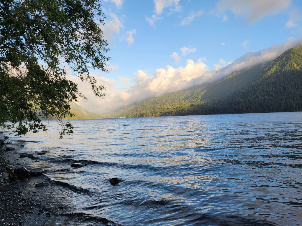
Day two of our trip dawned misty and gloomy, after off-and-on rain all night, with rain drops drumming on our campervan at Fairholme Campground in Olympic National Park. The trees were still dripping, and it was hard to tell whether it was raining or not, though there did seem to be a hint of bright sky and sun on the horizon.
I got up and started some water for coffee and oatmeal, and contemplated a piece of fruit for breakfast. Bones came with a pour-over coffee setup, which was perfect given that I was the only coffee drinker on this trip. We were looking for a quick breakfast so we could get moving and start exploring – we’d cook lunch later. I had put on my raingear before exiting the van, but sure enough, as I sipped my coffee while gazing at the lake, the rain slowed and we started to see hints of blue. Before long, Crescent Lake was beautiful again, framed by low-hanging clouds.
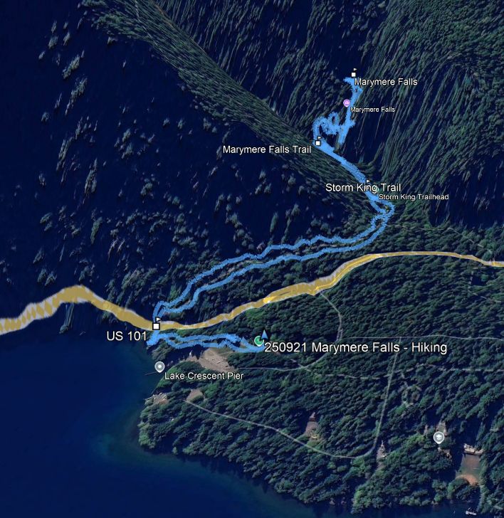
Our first destination was to be Marymere Falls, a short 1 mile (each way) walk up into the rainforest to what was advertised to be a spectacular falls. The trailhead was just down the lake from us, at the Storm King Visitor’s Center, so it was a good place to investigate early in the morning. Many signs indicate the way toward Marymere Falls, as it’s the most accessible scenic objective in the area, but the trail is actually listed as the Barnes Creek Trail.
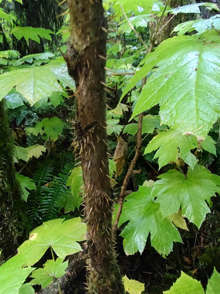
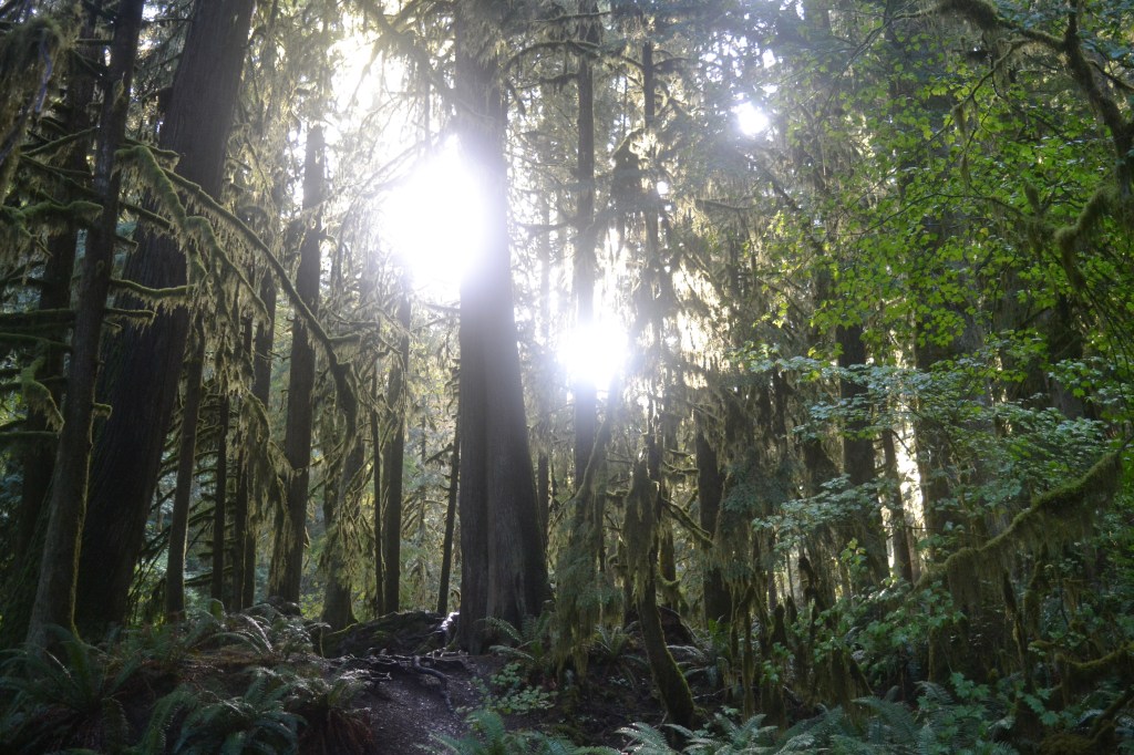
The trail starts along Crescent Lake, then passes through a small tunnel under US 101 before climbing very gently up the Barnes Creek valley between Mount Storm King and the Aurora Ridge. Though it isn’t labelled “rainforest” like the southern areas of Olympic (like Hoh, Quinault, etc.), the trees are covered with surface moss and draping club moss. This morning, maybe most mornings, the mosses were dripping with moisture, and the lifting fog gave a mysterious air to the forest.

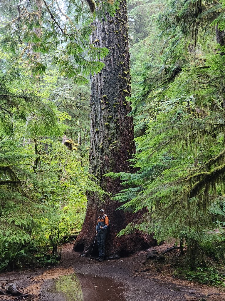
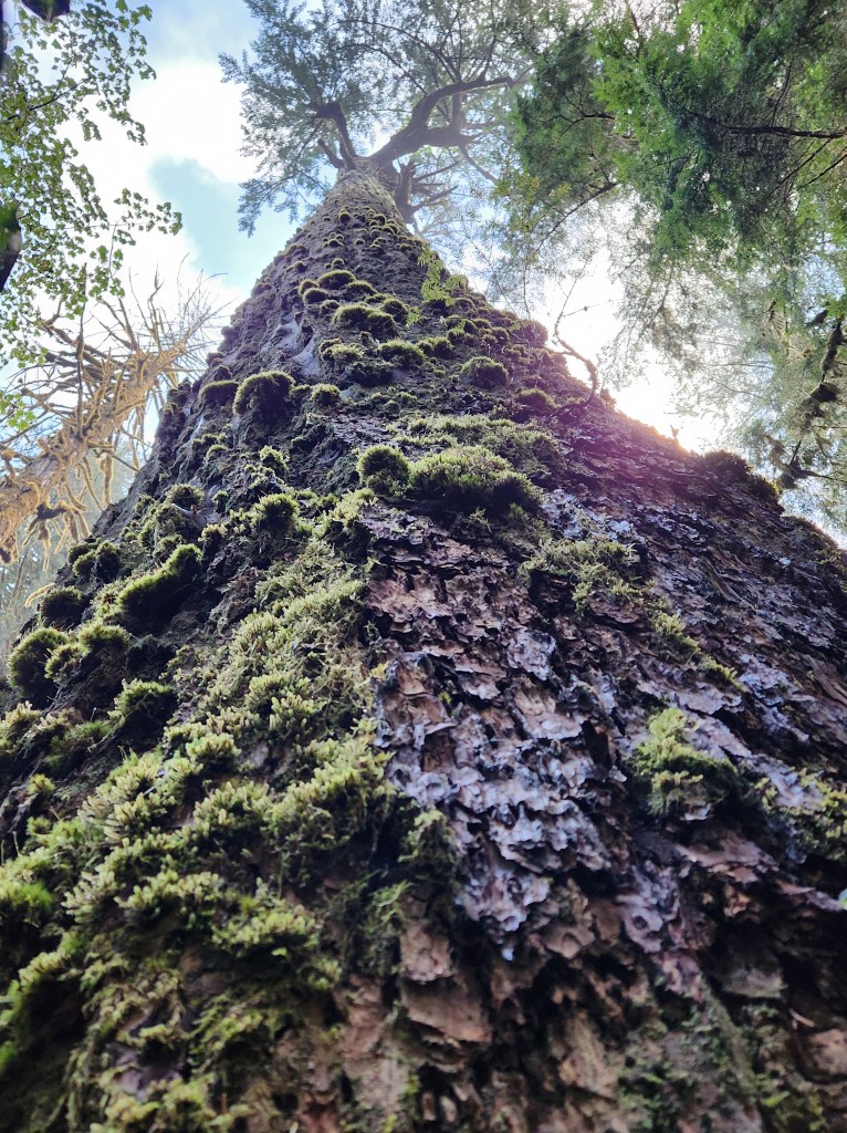
The trees were huge as well. We found one giant sitka spruce that rivalled the coastal redwoods of northern California. It had to be 250 feet tall, and was over 10 feet in diameter at the base. Pictures didn’t really capture the scale of this monster, though we tried.
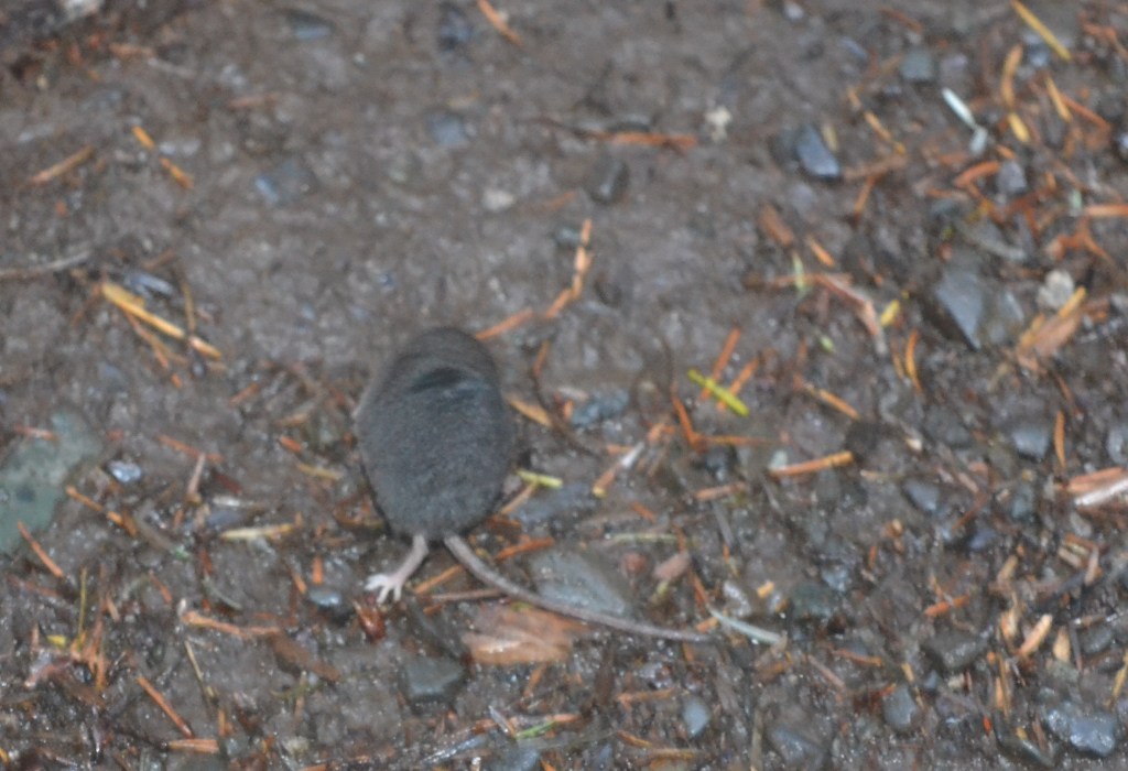
A little further up the trail, almost in contrast to the huge plants, we encountered a tiny animal. A Pacific shrew was running blindly (I think, quite literally) down the path, erratically zigging and zagging in a hectic search for something to eat. It would occasionally dart into the ferns and underbrush, but soon come right back out to the trail. At one point it ran right up to the side of my boot before stopping, and I stepped away because I honestly thought it might start climbing up my pants leg. It was fearless, but quick. Very challenging to get a good photo of, so I had to settle for a rear view as it ran away.
The primary path here, the Barnes Creek Trail, is well graded and wide. It climbs gently past the intersection with the Storm King Trail, which climbs up to a viewpoint on that mountain. Barnes Creek is always in earshot, somewhere off to the right, but it is distant enough that this feels like a forest walk, and not the typical climb up a creek toward a waterfall. Eventually, though, Marymere Falls Trail branches off to the left and very quickly crosses Barnes Creek on a substantial bridge before cutting back and crossing Falls Creek on a log bridge. From here, the climbing begins.
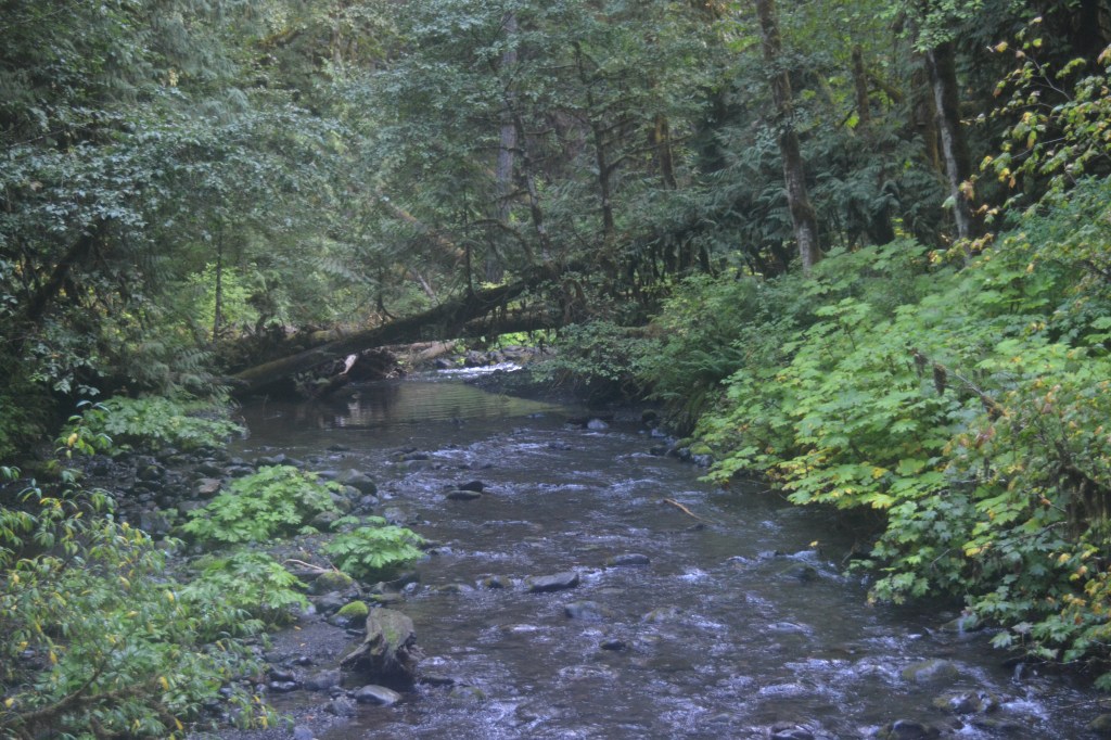
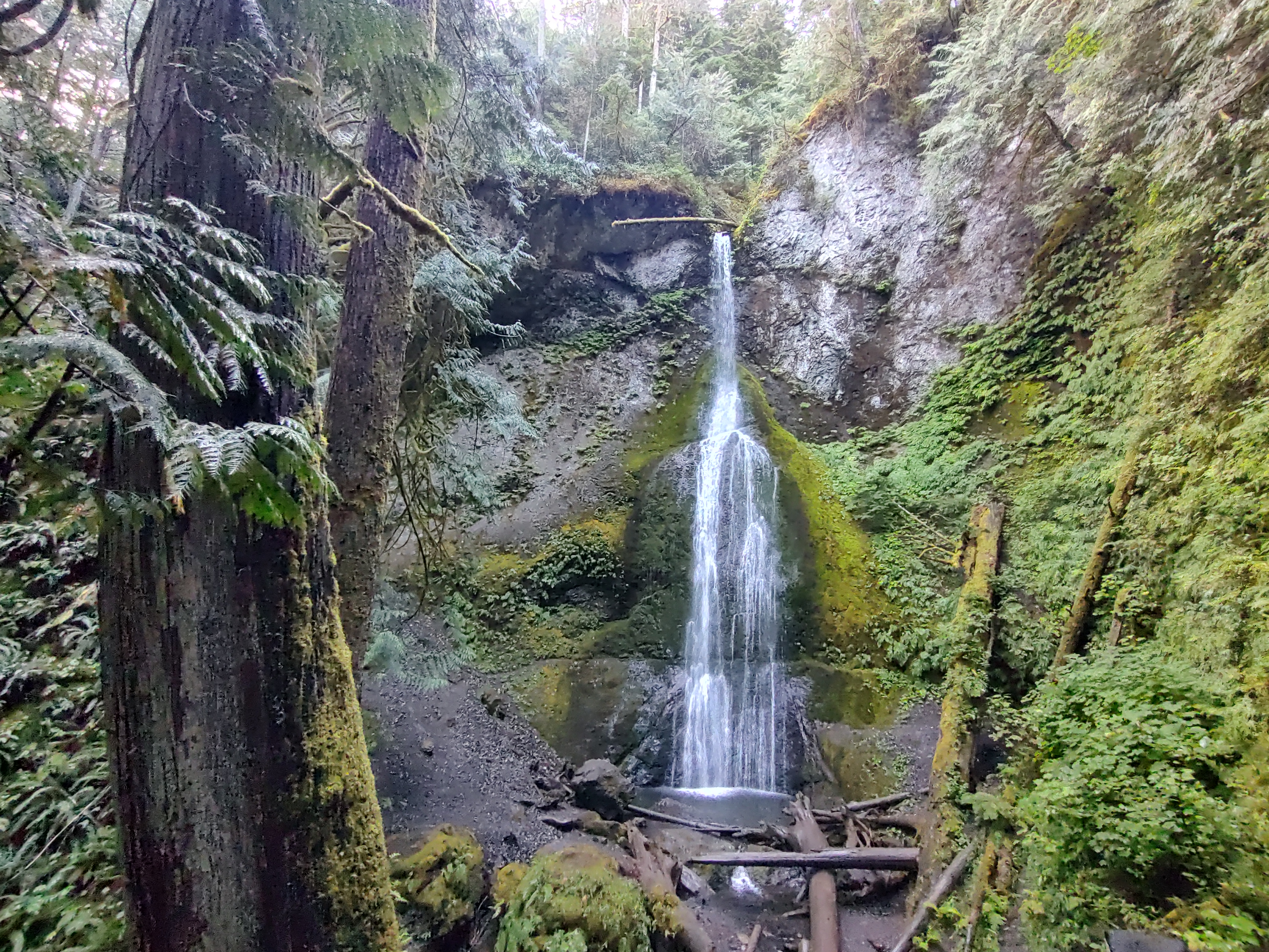
The trail is still well-graded, and makes use of both stairs and natural rocks and roots to climb fairly steeply up Falls Creek. Very quickly, the trail splits, and a sign indicates that the falls are to the left. In fact, this is a short loop, and can be followed in either direction, but the sign tends to make it a one-way clockwise loop by default. Taking the left fork, the climb is not far, and before long the trail pops out quite suddenly at the base of the falls, a gorgeous 90-foot drop from a narrow cleft in the valley.

We visited in September. Granted, this is an area of the country where rain is plentiful, but even so, the spring flow is stronger than that in September. Even so, the waterfall was healthy and the falls were beautiful. We tried to be respectful of the semi-professional photographer who had set up to wait on the emerging morning light, but our wide-angle GoPro on a trekking pole couldn’t help but reveal his presence.
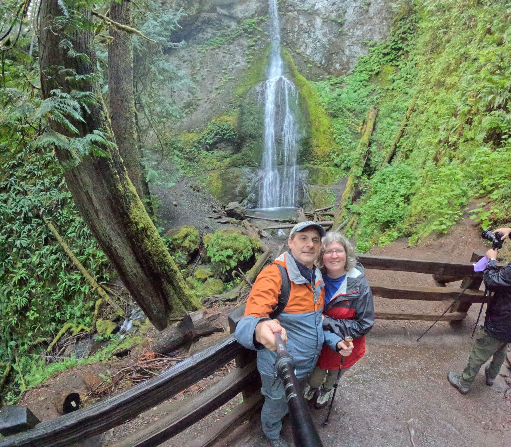
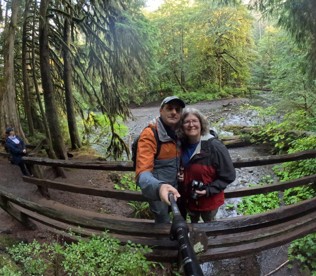
Leaving the falls, the trail climbs up another 75 feet or so to an elevated viewpoint of the falls. This is a great vantage point as well, though I like the lower view better.

From here, the trail continues around the loop and descends just as steeply back to the split and back across the two bridges. On our way back, we took more pictures of the increasing daylight, realized that the day WAS going to be a blue-sky, nice day after all, and once again encountered the frantic, wandering shrew.
When we parked Bones at the trailhead, we were one of maybe 4 cars there, but as we made our way back down the trail, we found a steadily increasing number of hikers, headed to the falls. The parking lot seemed full by 9:30 (on a late-summer Sunday). So I would presume in the spring and summer this is a particularly popular destination, and getting here early is advisable.
Objective one, for us, was complete. From here our route would take us back out to Port Angeles so we could circle back on a missed Day One objective – Hurricane Ridge!!
Key Parameters:
Length – 1.1 miles each way (2.2 mile round trip)
Ascent – 330 feet; Descent – 330 feet
Trailhead – 48.05795, -123.78913
Get Out There

The mossy forest looks enchanting. We hiked to Marymere Falls when we visited Olympic a couple of years ago. I had just found out I was pregnant right before we flew to Seattle, so this really brings back fond memories.
LikeLike
Glad I could bring back a memory, and happy to see the little one hasn’t slowed you guys down at all!
LikeLiked by 1 person