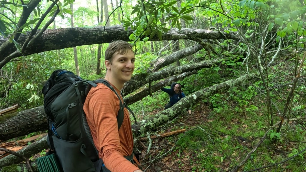
Back on May 15-17, after my wife and I had driven to Tennessee to help move my son out of his apartment for the summer, and after she’d started the drive back east with a car load of his “stuff”, my son and I embarked on a 2-night, 26-mile backpacking trip in the southeastern portion of Great Smoky Mountains National Park.
Finding a suitable route was challenging – many trails in the park remain closed or restricted after the damage done by Hurricane Helene in the fall of 2024. The area we selected still warned of several bridges washed out in the creeks in and around Cataloochee Valley, and warnings stated that while the Pretty Hollow backcountry camp (#39) was open, the trail leading to it was washed out and closed to horses. In addition, we were to expect numerous fallen trees across trails throughout the route.
Key Parameters:
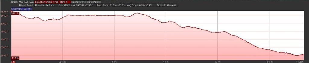
Length - 25.8 miles
Ascent / Descent - 6,200 feet
Water - Plentiful below 3,800 feet and along Palmer Creek, Pretty Hollow, Little Cataloochee and Long Bunk Trails. Seasonal springs on Mt. Sterling ridge, and at Laurel Gap Shelter.
Camping - Backcountry sites at Mt. Sterling (#38), and Pretty Hollow (#39). Laurel Gap Shelter.
Other Considerations - Backcountry camping must be reserved through GSMNP website, park entry is free but a $5/day parking permit is required.
Trailhead - Mt. Sterling (35.70031, -83.09749)
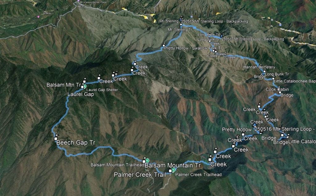
Day 1 – Mt. Sterling
We chose to start at Mt. Sterling Trailhead (35.70031, -83.09749), accessible after a long climb on a single-lane dirt road from Waterville Road off Interstate 40, right in the heart of damage from Hurricane Helene. This is the section of interstate where the Pigeon River washed out the eastbound lanes, and though the roads are now open again, they are under construction, subject to nightly closures, and a temporary traffic signal guarding the one-lane road into the Big Creek Ranger Station area of the park.
Mt. Sterling was a challenging drive, but it got us to a point where we could make a quick entry into our trip. Day 1 was only 2.8 miles of walking, but that contained 2,000 feet of climbing up to the summit of Mt. Sterling and its namesake campsite (#38).
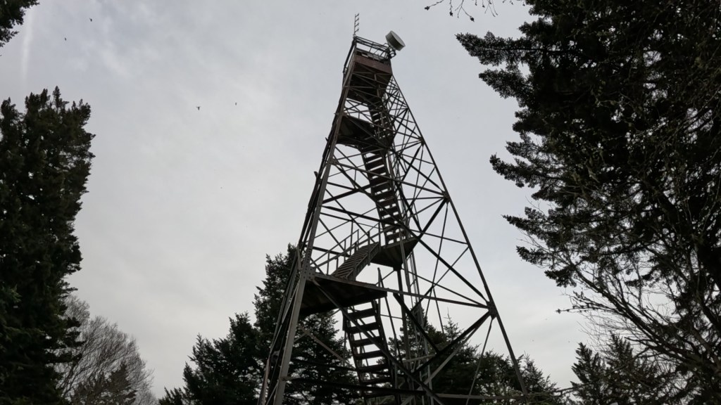
We climbed from deciduous hardwood forest up through stands of fir, surprised at how many springs were flowing even above 5,000 feet. It was a long arduous climb – the toughest, most continuous ascent of the entire trip, that ended at an open fire tower on the summit (5,843 ft). Mt. Sterling itself is wooded, but the fire tower offers great views in all directions, provided you can stomach the exposed climb to the mostly glassed-in observation room at the top.
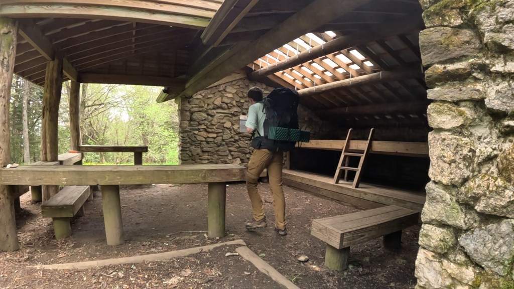
Camping in the Smokies is abundant, but regulated. In order to minimize impact, the Park has established backcountry sites with fire rings and bear-bag cables for hanging food. Dispersed camping outside these sites is prohibited. There are LOTS of sites, and each has a maximum capacity for which the Park will accept reservations. We didn’t have any problems reserving the ones we wanted for Thursday and Friday nights, respectively, but that’s not always true. It does mean you have to plan your itinerary carefully.

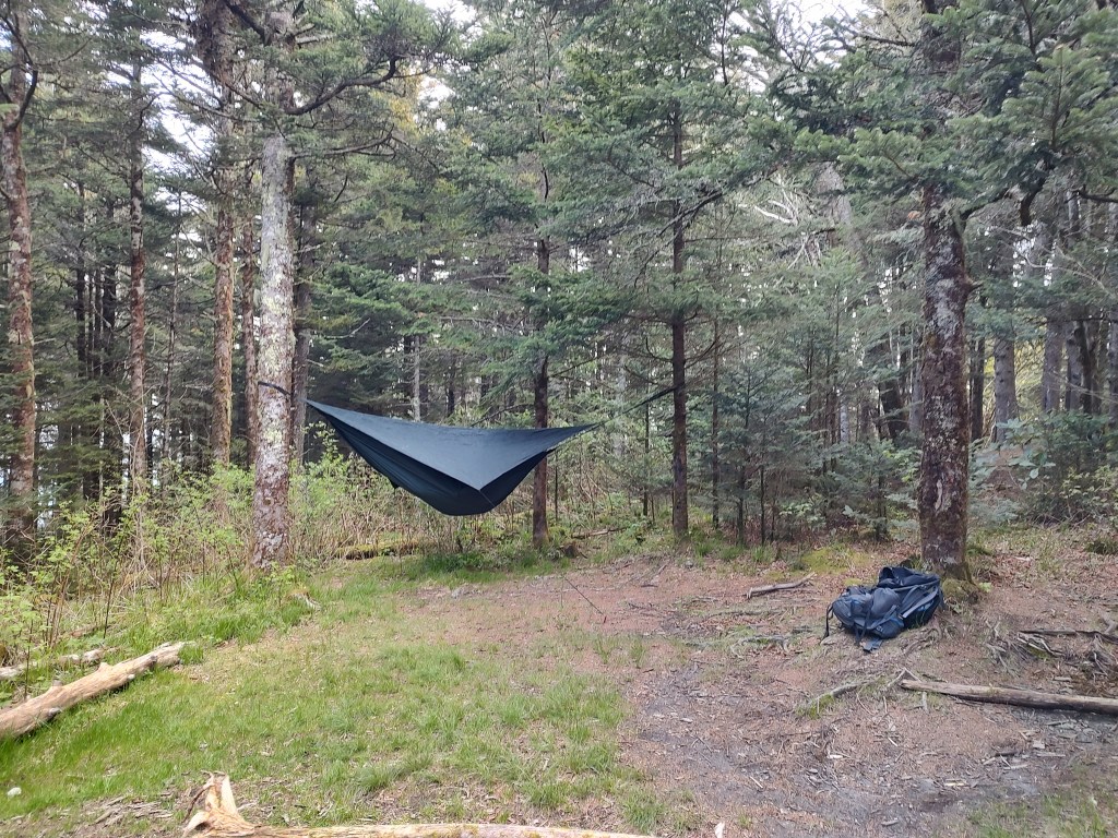
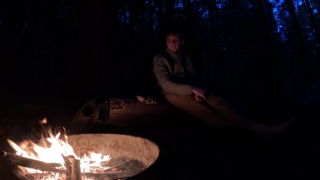
We set up camp – I in my tent, my son in his hammock, and got two stoves going to make a Thai green curry for dinner. I cooked the sauce, containing green curry paste, coconut milk, veggies and canned shrimp, while he cooked the rice noodles. As the sun set and darkness started to fall, we enjoyed the hard-earned calories while the wind picked up and started to blow fog through the trees and across the mountaintop.

After the skies grew darker, we could see almost continuous flashes of lightning and hear thunder off to the northwest. With growing wind and possible storms headed our way, we decided not to build a campfire, opting instead for an early bedtime.
Sometime in the middle of the night, it did rain hard, and abruptly, but only for a few minutes to disturb an otherwise peaceful night with the continuous white noise of wind through the fir trees.

Day 2 – Down, Down, Down to Pretty Hollow
Friday morning dawned cool and clear, and I woke up ready to go. My son begged for a few more minutes in his hammock, so I worked on breakfast while I packed away my tent. We had a hearty scramble made from instant egg crystals (Ova Easy – my first time trying them, and we were both pleasantly surprised), dried/reconstituted hash browns, fresh chopped onion and green pepper, diced pre-cooked bacon, and cheese. Tasty!

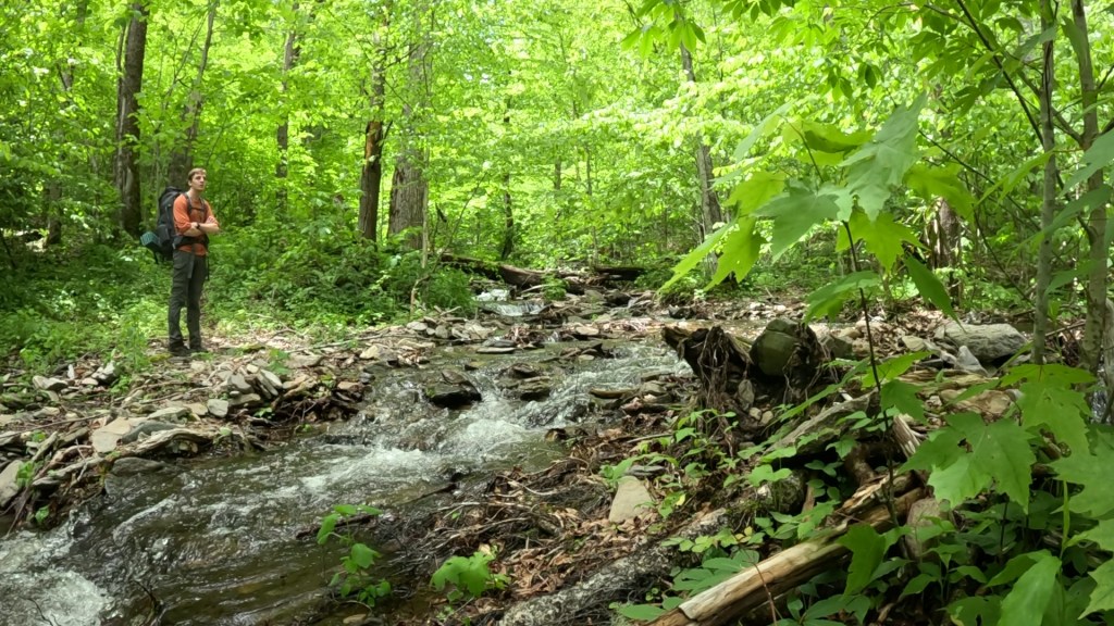
With that as fuel, we set out on what was to be a 14.6 mile day with a net elevation change of -2,800 feet. Cumulative descent, including some ups and downs along the ridge, was close to 4,000 feet down. Our route would take us southwest along the Mt. Sterling Ridge to the Balsam Ridge Trail, where our descent would really begin after about 6 miles of walking. We’d take Balsam Ridge out to the trailhead at a dirt access road that we’d have to follow about 0.6 miles to the Palmer Creek Trail, then down and eastward into the creek valleys, through several deep crossings to the reportedly washed-out Pretty Hollow Gap Trail, where just a quarter-mile of potential bushwhacking would take us to Pretty Hollow camp (#39) for the night.
Our primary concern as we set out was water. Being on a mountaintop, the site at Mt. Sterling is a dry camp. We had started at the trailhead with 5 liters between us, consumed a liter a piece on the hard climb up, and then used two more on our elaborate meals. So we left the Mt. Sterling site with about half a bottle a piece, and at least three miles of ridgetop walking with little hope of replenishing the supply. We were optimistic, though, based on seeing high-elevation springs on the climb up, we’d encounter water at one of several drainages as the trail looped around and under the summit of Big Butt Mountain. Between here and there, the trail would undulate a bit, up and down along the ridgetop, but we didn’t expect anything particularly arduous.
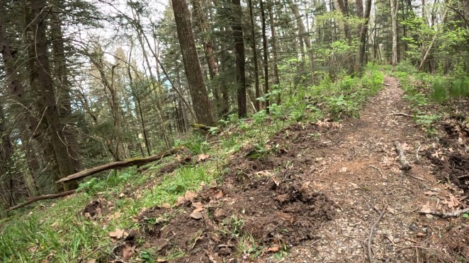
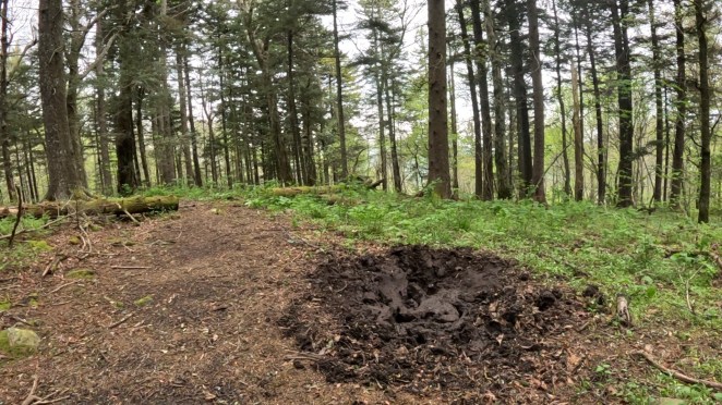
With water on our minds, we were completely surprised when less than a mile from camp my son spotted something large, black and furry in the path up ahead. He instantly thought “bear”, and then noticed it had a swishy, hairy tail. When it ran away we both quickly identified it as a wild pig. We had no idea there were pigs in the Smokies. I wrote a post last week about what we’ve since learned about these animals, and where they came from. From this point forward in our trip, we would see a lot of damage the pigs cause – extensive areas of rooting, and several large, muddy wallows.
After about two miles, we were faced with a decision. We reached the intersection with the top of the Pretty Hollow Gap Trail. A left turn here would amount to a significant short-cut, dropping us straight down the mountain, past quick and easy access to water, to our intended campsite less than 4 miles away. Our planned route would take us about 12 additional miles to the same spot. Feeling good, we decided to press on with the original plan. We wouldn’t exactly regret this decision – but the wear and tear of the extra miles AND the descent were to prove painful over the course of the day. Still, my son wisely said later, “You know there was no way we’d ever not try and complete the original route.”

My son had emptied his water bottle, and I was down to about half a cup, when water did materialize as planned, just as we thought it would, about 4 miles in. Under the shoulder of Big Butt Mountain, we started to encounter significant springs, and before long we felt silly that we’d ever worried about it – the creeks coming off the summit were actually pretty substantial, even up at 5,500 feet.
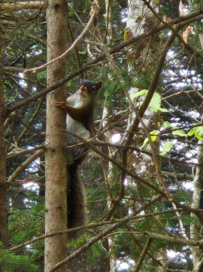
Everywhere we looked, wildlife looked back. The pigs, sure. But then there was a group of animals – maybe pigs, maybe deer – running through the underbrush down the hill, just out of sight. There was the sound of a ruffed grouse drumming, woodpeckers haven’t away. Chipmunks and squirrels ran through the fallen and upright trees, respectively.
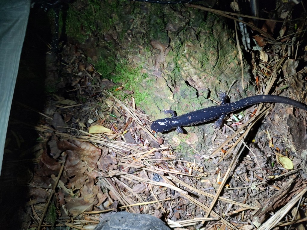
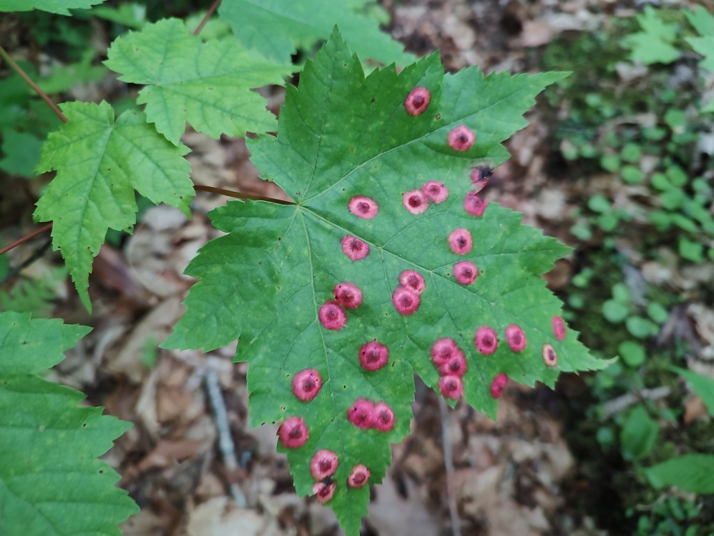
There were smaller creatures too. Shiny black salamanders creeping under the leaves. Large snails. A unique (to us) black and yellow millipede that we examined with great interest the first time we saw it, and then became a running joke where one of us would just yell out, “millipede!” as we walked by. We must have seen hundreds before the trip was over.
As we made the left turn onto the Balsam Mountain Trail, we saw a grouse up close as it ran/waddled across the trail in true mountain-chicken style. Soon after, we encountered one of only two other hikers we’d see on the trail. (There had been a trio of college-aged guys at the Mt Sterling site, but they left early). Turns out the section we were traversing – Balsam Mountain and Mt. Sterling – are also part of the 290-mile Benton MacKaye Trail, and the guy we met was on THAT journey. Unfortunately for us, that meant he couldn’t share much on the conditions of the creek crossings to come.
It was too early for lunch, but we enjoyed a snack break at the Laurel Gap Shelter, a little over 6 miles in. To this point, we’d barely lost any elevation, but the plunge was coming.
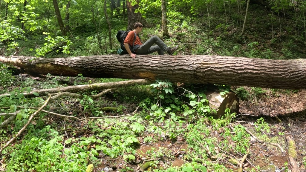
Leaving the shelter, we went up, briefly, and then started the long descent into the valley. We paused for lunch at Beech Gap, where a large fallen log made an inviting seat. We had tuna, cheese and pesto wraps. The pesto was supposed to be cooked a bit, to thicken it and concentrate flavors, but neither of us felt like dealing with a stove or the cleanup, so we just put watery pesto mix on our sandwiches and called it good. It still took a while for the blood sugar to ramp back up!

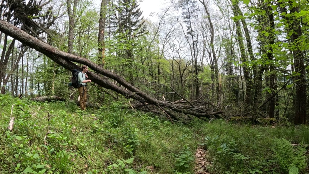
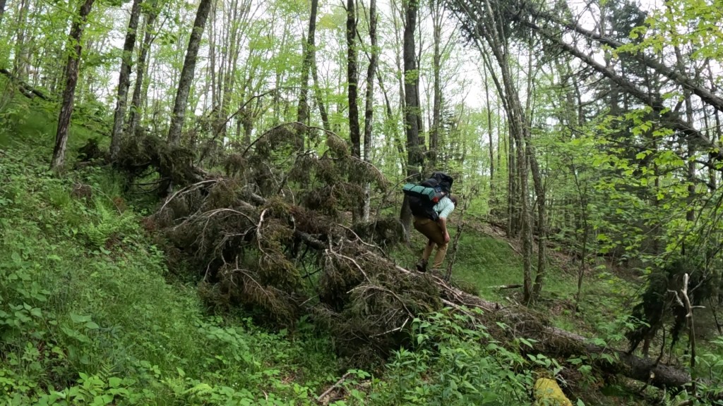
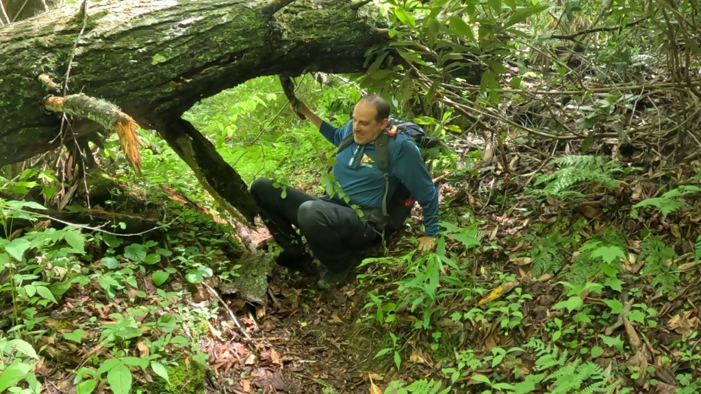
We were starting to feel the effects of the mileage. Not any particular exertion other than repeated footsteps, and calves getting sore from arresting the descent. Blowdowns (fallen trees) were getting more frequent as we got lower too, and each one presented a new puzzle as to how to get by. We noticed a lot of the downed trees had leafed out, meaning they likely didn’t fall during the hurricane, but we’re maybe damaged enough so that a recent storm was able to bring them down. Of course, live branches full of leaves made navigating through our around them even harder. There was nothing to do but press on.
A little over 10 miles in, we emerged into a gravel access road at the Balsam Mountain Trailhead. Originally, I had planned to start the trip from here, but road access was currently shut down due to damage deeper in the valley. So, we flipped the trip to start from the opposite end at Mt. Sterling, which gave us a short first day to get to camp. Regardless, we now had a short (0.6 mile) walk down the road to the next trailhead and turn this journey into a loop. With the road shut down though, we still had it all to ourselves… Almost.
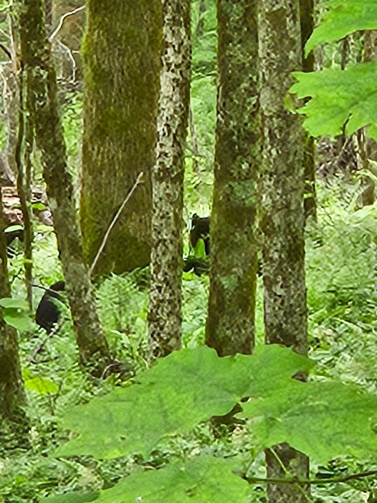
About halfway down the road, I looked down the hill to the left and saw a bear looking back. Three of them. A mom and two cubs, about 50 yards away. I believe they would have been perfectly content to let us walk by, but since we stopped and noticed them, they felt compelled to respond. One cub made one tentative hop up a tree, but Mom called it back, and all three simply walked down the hill, away from us. A neat encounter we could have easily missed.
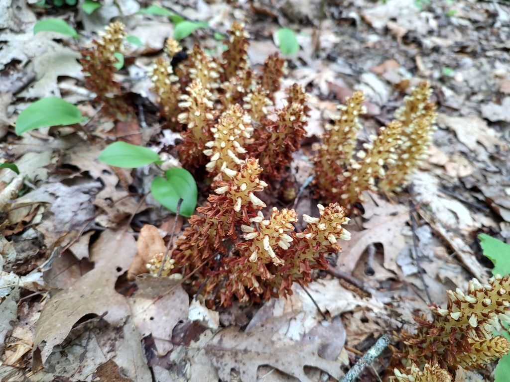
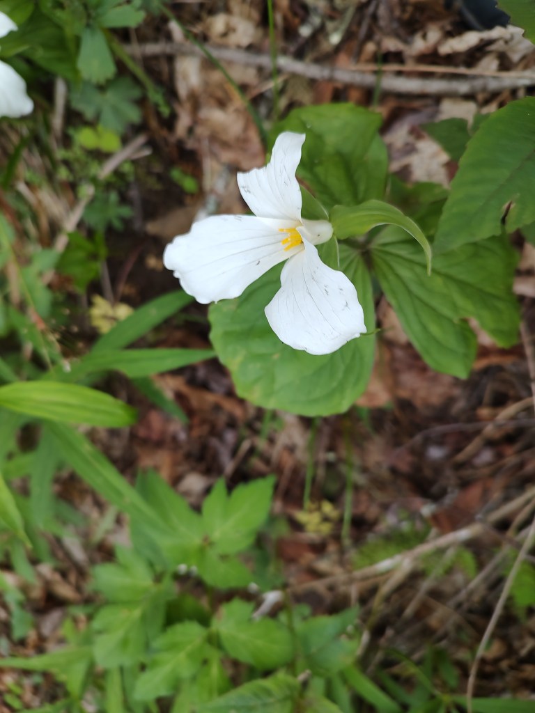
We had long since descended out of the dark fir forest and into brighter, greener deciduous hardwood (oak, maple, poplar), but at the Palmer Creek Trailhead, the plant life changed again. Much of the path ahead would be through Mountain Laurel thickets, often in a tunnel of them, as the sound of a raging creek reached us from far below and to the south (our right). Blooms on the Laurel depended on elevation. At the trailhead they were just buds, but the deeper we went the more substantial they became.
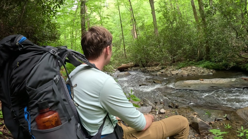
After about a mile, we saw the river for the first time. It was narrow, maybe 10 to 12 feet wide, but it was a raging torrent, dripping over and around boulders. A slightly (but only slightly) scaled-down kayaker could have experienced quite a ride.
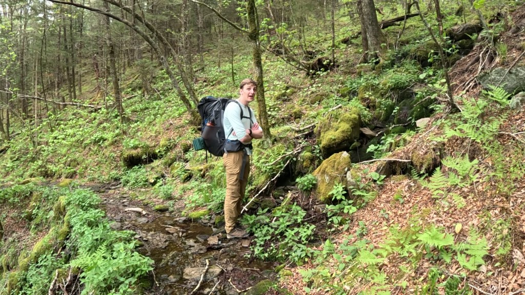
Not long after this, we had to deal with crossing our first of several tributaries to this creek. Each stream seemed deeper and more powerful as we descended, but all of them were moving fast, filled with slick rocks and deep holes. At the first, there were obvious signs of a landing for a bridge on both sides. A small plaque on a tree indicated the bridge was made in honor of some benefactor. But there was no bridge to be seen, it having been a victim of Helene and its floods.

There was no way to stay dry. The first was crossable without getting much more than ankle deep, but by the third or fourth, we were in up to our knees, and then only after evaluating every potential death-defying jump across a waterfall to avoid it.

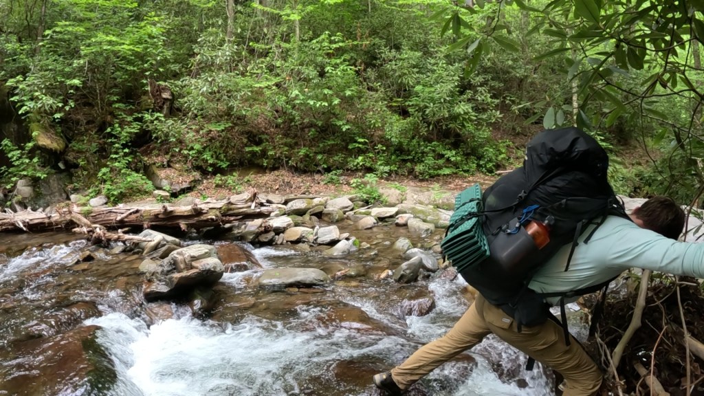
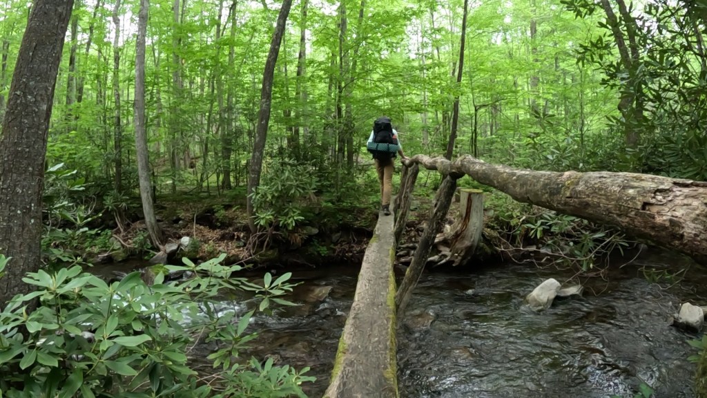
The crossings were clearly getting worse, the sheer noise of the streams was getting louder, and we knew we’d soon be flattening out into a valley where the trail was advertised to be washed out. We were starting to have serious concerns about whether we could cover the last quarter-mile to camp, when, to our immense surprise, the last and most formidable tributary, flowing down out of Pretty Hollow, and an intact bridge crossing it!
Our joy was tempered with pain, though. Our calves were feeling the descent, and our legs were tired of walking. My son announced, “I’m going to get to camp, put up my hammock, get into my hammock, and just lay there for a bit.” I couldn’t argue. We had one more significant blowdown to navigate, but the trail wasn’t as washed out as we worried it might be (meaning it likely was worse downstream, and we’d encounter some of that damage in the morning).
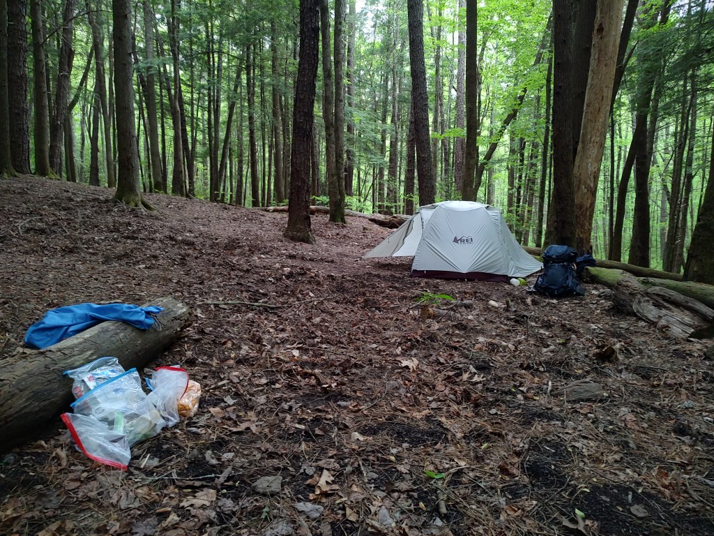
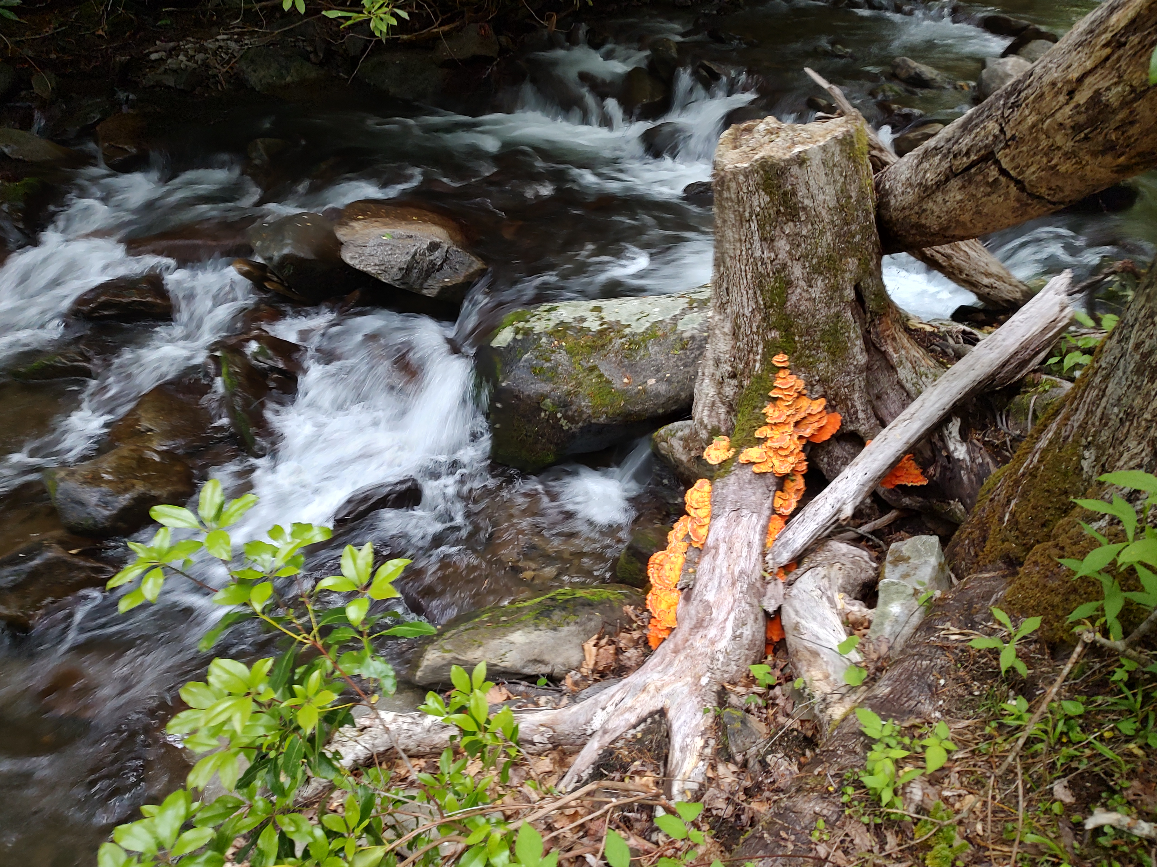
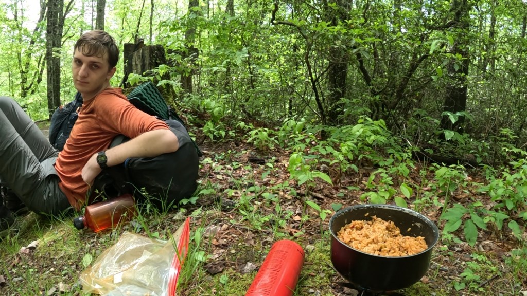
Pretty Hollow camp had a lot of pig rooting damage through the site, but I was able to get my tent up and start working on dinner while my son started working on drying out his boots. By the time dinner was ready, though, and I had made a trip to the creek to refill water bottles, my appetite wasn’t up to the task – probably just because of overall fatigue. We decided to pack up half of dinner (Jambalaya made from a pre-seasoned rice mix with added chicken, chopped up beef stick, and the remainder of onion and pepper from breakfast) in a ziplock for later.
Despite the damp, we got a fire going to try and get a head-start on drying our boots and socks, and went to bed early, soon after nightfall.
Day 3 – Back To The Trailhead
Overnight, it rained again. It rained hard. We started with some drizzle around 3:30am, and within an hour we were subject to some fairly intense thunderstorms. Rain pelted the tent and drowned out the white-noise sound of the nearby creek, and it continued to rain aggressively until about 7am. That was the time I realized I could hear the creek again, and the dripping onto the tent was more indicative of water dripping off the pine trees above than from a steady rain.

A lot of water came down in that period of time. I kept sticking an arm out of my bag to feel for puddles (thankfully none), but my son did get some rain penetrate the fly of his hammock and get in – though not enough to seriously disturb his sleep. The creek, meanwhile, came up somewhere between 8-12 inches overnight. The rock I had sat upon to get water the night before was completely underwater in the morning.
We learned later that this same system spawned flooding and several tornadoes in Kentucky.
Our concerns were more local. We didn’t have to cross the creek we were camped next to, but we DID have to cross at least two more that were collecting water from, and dropping essentially the same distance out of similar watersheds. We were very concerned that we might not be ABLE to cross, if those creeks looked anything like this one. In that case, our only way out might be straight back up the Pretty Hollow Gap trail, all the way to the ridge at ~5600 feet and to the “short-cut” intersection we’d passed the day before.
Hoping that wasn’t the case, we skipped breakfast, electing to snack instead as we got things packed up. We were sure we were going to get wet again soon, and we wanted to get it over with.
As we got going, the clouds broke up and we started to see sunlight and blue skies, but beyond the Palmer Creek Trail intersection our path indeed became hard to follow. The trail itself became a creek, running in a channel parallel to the main stream and showing signs of serious erosion and scouring of earth and rock during the hurricane floods. At one point we were traversing downstream in a gravel bed when we looked over and realized we were walking on ground at least a foot below the water level of the raging main stream! Water was trickling through and over several places in the earth acting as a dam between us and the river, so we quickened our steps.
The bad news: we did have some early creek crossings. Good news: they weren’t bad, and at least one still had a bridge intact. Before we expected it, we reached the intersection of the Little Cataloochee Trail and headed up and away from the water. Of course trails going up still tend to follow descending creek valleys, so we still had a few crossings to deal with, but the erosion and destruction was less formidable as we got into elevations that just hadn’t been able to collect as much water during Helene.
Our campsite was 800 feet below where we left the car, but we had about 2,400 feet to climb over the remaining 10 miles of our trip. First, 1,000 feet up and over a ridgeline, through a gap, then back down into the old frontier community of Little Cataloochee, then up to rejoin the Mt. Sterling Trail at a point about 400 feet higher than we needed to go before dropping back to the trailhead.
The climb up and over the first gap was steep in places, but not horrible. Difficult enough that we paused in the gap for some calories before descending the east side of the ridge and soon joining another creek. Shortly after we started hearing water, we looked across the creek to see another pair of bears – this time a mom and a single cub.
These were much closer than our previous encounter, maybe 30 yards, and the bears had the high ground this time. However, mom looked less angry than annoyed. The cub turned tail and started running up the ridge behind it, while mom looked from us, to the cub, back at us, back at the cub, and then looked at us as if to say, “Really? Look what you did. Now I have to go chase that!”
Eventually she turned around and ambled very slowly up the hill, in a different direction from the cub. We trusted they knew how to communicate, and were eager to leave them alone. Despite the better opportunities, we failed to get any pictures of these two. Our proximity meant we were occupied with talking and moving, not pulling out cameras.
Below the bears, we passed a park service pig trap, and then came around a corner to see an old log cabin! This wasn’t marked on my Gaia map (I’m sure it would have been on a park service map), but we learned it was the Cook Cabin. The roof was sagging, and the front porch had collapsed, but the door was open and we stepped inside to wonder how many people had lived here and for how long.
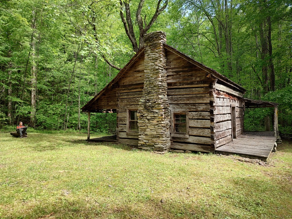
The trail at this point became another dirt road (also unexpected) which clearly served the community of Little Cataloochee. In addition to the Cook Cabin, there were foundations across the street. About a mile away we encountered the Little Cataloochee Baptist Church, complete with a bell in the tower. We agreed it would be great to hear that bell echoing through the valley.

We also saw a turkey hen run across the road and take flight in front of us. And later a tom turkey, and then again later the back of coyote running into the brush away from us. Wildlife everywhere!
Past the church, we found the Hannah Cabin, and then finally reached the intersection with the Long Bunk Trail, where we decided to take a break for lunch. We broke out the stove and the leftover jambalaya from the night before, and got that cooking with a little water to steam it up. From here on out, we’d be in a fairly steady climb all the way home, and jambalaya as fuel really hit the spot.
We also had another on-trail encounter here. A woman in her 60’s was attempting to hike every single mile of every trail in the National Park, and she only had four trails left to go. She had just come down from Mt. Sterling (and shared some warnings about still more wet creek crossings and blowdowns we’d have to face), and needed to do a quick out and back to the Cataloochee Trailhead before reversing our course back toward Pretty Hollow. I hope I’m still hiking at her speed when I reach her age!
As warned, the rest of our trip included a few more creeks, and many more fallen trees to navigate. Mostly, it was just up. We kept a close eye on our elevation, marking progress against the 4,200 foot high point – and then when we finally reached it, we regretfully had to go back down 400 feet to the car. After all this hiking, the most damage seemed to be to our down-muscles, our calves in particular.
But we did make it, and we got back out of the mountains, and we found a Chipotle. All was good.

There are LOTS of good circuits like this that can make for outstanding trips in the Smokies. A little planning is necessary, and the scheduling system is not very permissive of deviations from plan, but if you’re willing to stick to an itinerary, there’s a lot to be experienced. We saw several different ecosystems, from high ridges to deep creek valleys. We used elevation changes to go back and forth through time and watch different stages of flowering plants. We saw lots of wildlife (and zero deer, oddly enough!), and we had a good quality time to bond as father and son. I highly recommend it!
Get Out There!

It’s great that you were able to get away with your son for a multi day backpacking trip in the Smokies. Great picture of you guys in the fire tower. Glad to hear you managed to find water along the trail. The creek crossings do not look fun. Thank goodness there were a couple of bridges still intact though. It’s impressive that the woman you encountered is making an attempt to hike every trail in the park and only has four trails left. That’s impressive! I hope I’m still hiking when I’m in my 60s too!
LikeLiked by 1 person
The changes in elevation really added a lot of variety to this trip, difficult as it was! Definitely looking for some other destinations in the Smokies!
LikeLiked by 1 person