
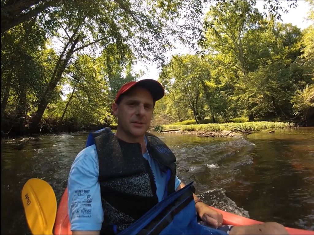
Several years ago, I started paddling sections of the Mattaponi River one of the two primary tributaries of the York River (the other being the Pamunkey), in eastern Virginia. It’s a beautiful, narrow stream with low but steady current despite only a slight downhill gradient, and its rural watershed transports a paddler into what feels like a remote wilderness very quickly after putting a boat in the water.
There are no significant urban or developed areas in the entire Mattaponi watershed. Most of the land around the river is either forested, marshland, or farmland. The water is darkened with tannins, but there’s very little visible evidence of human habitation. There is a remarkable lack of litter along the banks or in the water, and there is an abundance of wildlife – otters, deer, raccoons, and many species of birds. However, despite its remoteness, there are traces of industrial contaminants here, in the form of PCBs and mercury, so fish contamination should be limited.
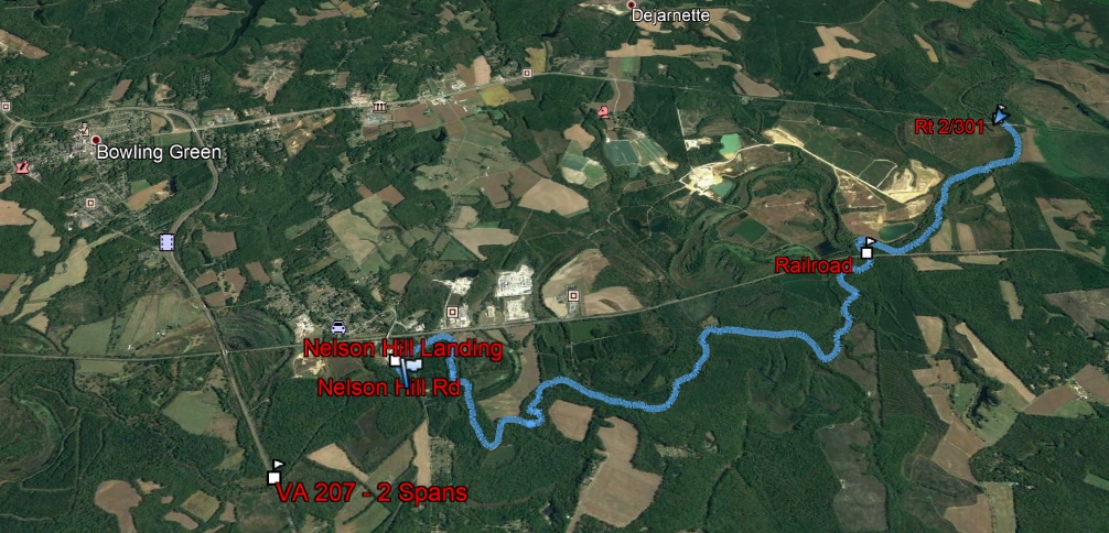
So far, I’ve completed two sections, and plan to continue downstream in the near future. Here, I’ll summarize my experiences with the two navigable sections starting as high in the watershed as practical, from VA Rt 605 just west of Bowling Green, VA. (Some might argue that the river can be floated above this, and that may be true at certain water levels, but in my opinion the frequency of down trees and other blockages above 605 make it not worth the effort.)
Rt 605 to Nelson Hill Landing – 4.3 miles
The river through this stretch varies in width between 15 and 60 feet, and is mostly flat though it contains a few riffles over gravel bars and downed trees.
When I paddled this section, I had to haul my boat (10′ Pelican kayak) over five separate trees, though they were all fairly simple – pull up parallel to the trunk, get out of the boat onto the tree, pull the boat over and get back in. I also did this as an out-and-back, which means I had to navigate the obstacles TWICE, but is also evidence that the current is light enough to go back upstream without much trouble.


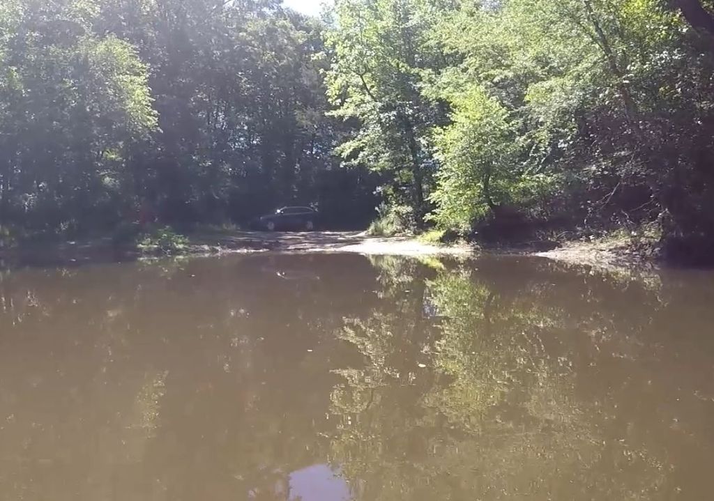
Parking and water access at both ends is straightforward, with gentle slopes into the water making for easy boat entry and exit. When I ran it, the water level on the Bowling Green gauge was 2.19 feet. I would estimate that 2.0 is a reasonable minimum.

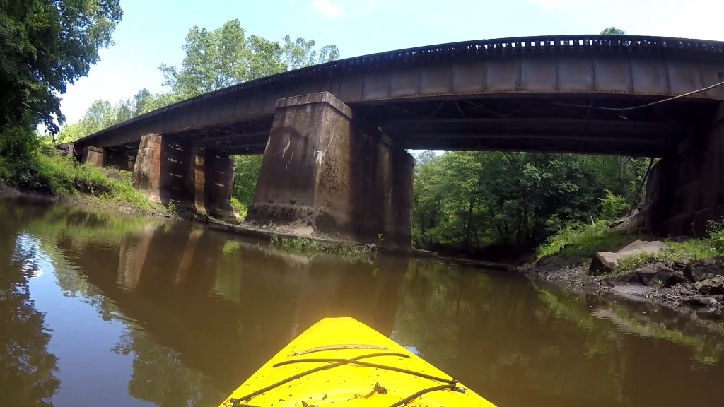
This stretch of river is beautiful, with the only indication of human proximity being a couple fences along the bank, a few “No Trespassing” signs, and a brief dalliance with the railroad (which sees a fair amount of traffic, but I only noticed when looking up a side creek and saw a culvert under the rails).
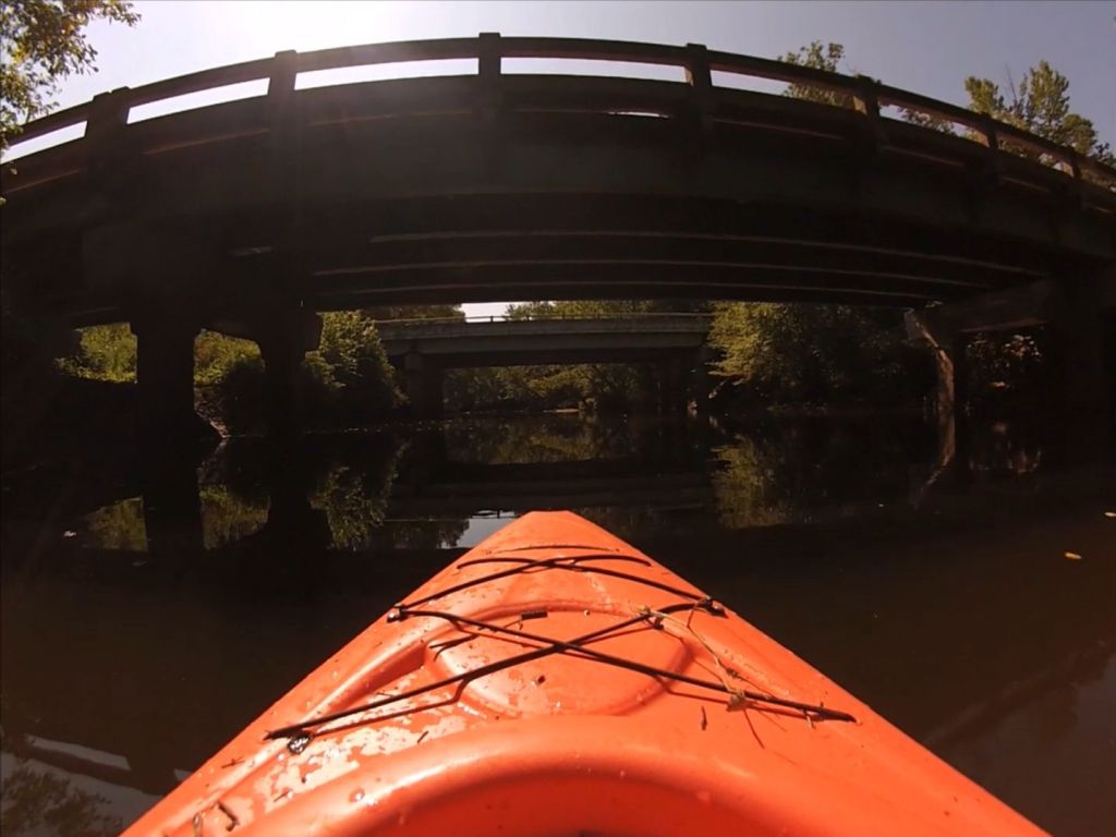
Just after the put-in, the river passes under Rt 605. After about 4 miles, you’ll pass under the double-span of Rt. 207. About a half-mile later, you’ll see the large river access area, Nelson Hill Landing, on river right.
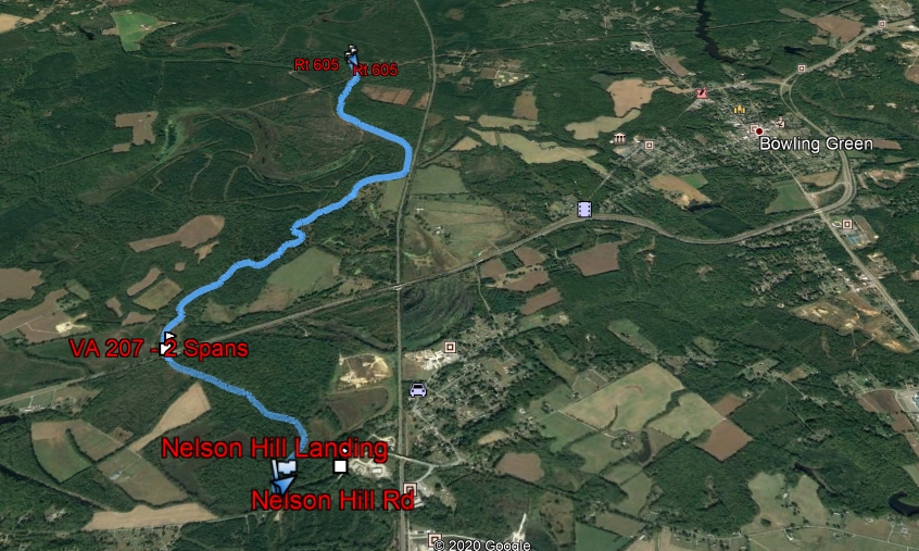
Nelson Hill Landing to US 301 – 7.5 Miles
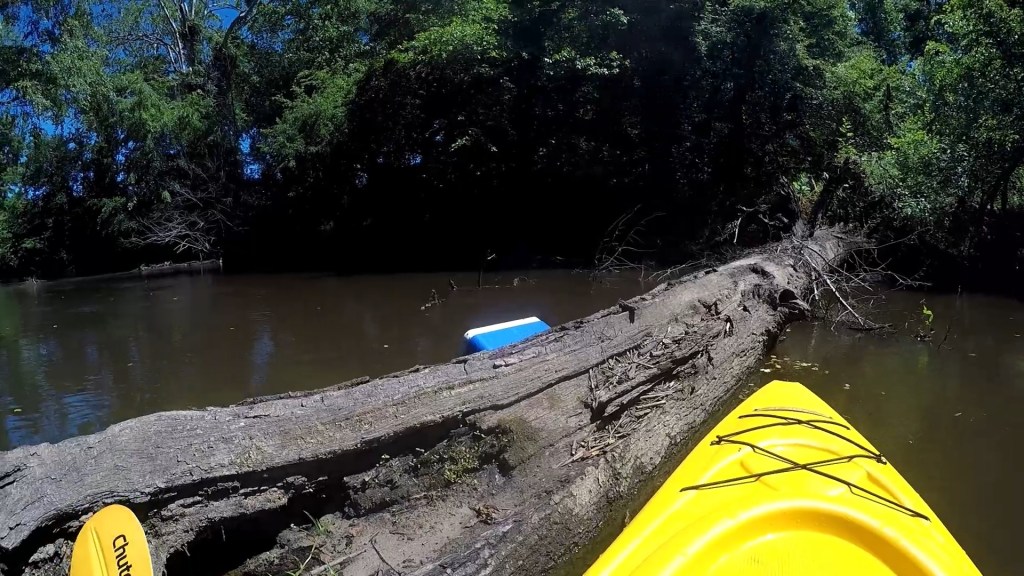
The river here is very similar to the earlier stretch, though slightly wider on average. There are several places along this stretch where there are minor islands in the stream, forcing you to choose a channel. On several of these, I would pick a side, find it to be blocked, and then have to go back upstream and try the other channel – which a few times, was ALSO blocked.
In fact, I found a lot of obstacles on this section – I had a total of 11 to navigate. Several times, I would be approaching a downed tree but found as I got closer that through some careful maneuvering I was able to pass over or under without issue. At least once though, I had to beach the boat and walk downstream over and around the crown of a large tree. I was glad this was a one-way trip!
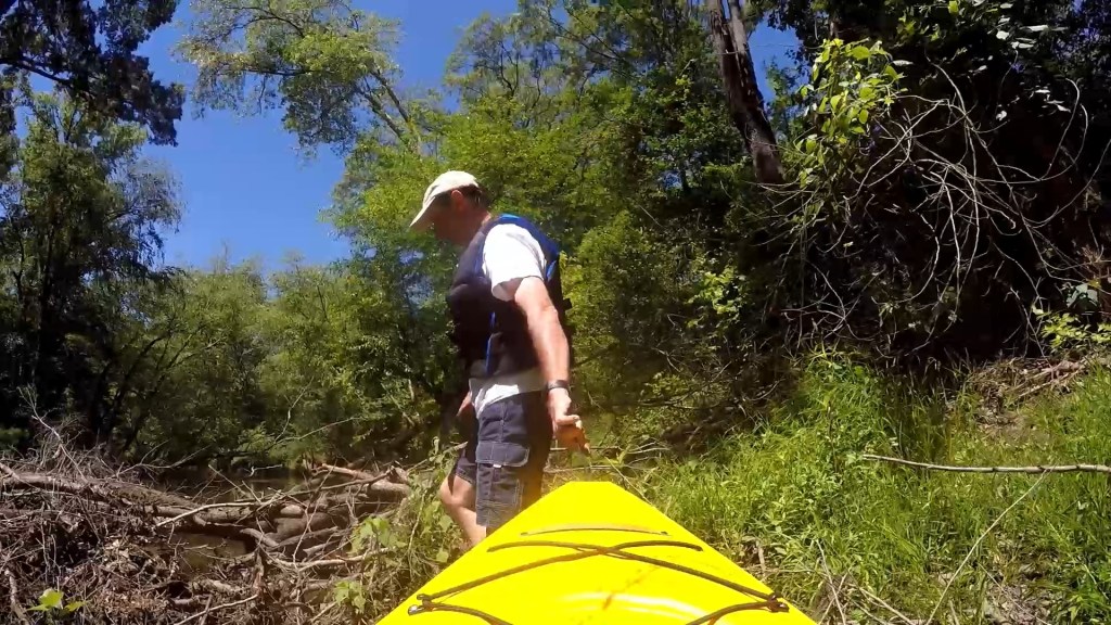
In order to make it a one-way trip, I left a bike in the woods at the 301 access point, so that after paddling I was able to ride back to my car, then return to retrieve the boat. The bike ride was far more difficult than the paddle.

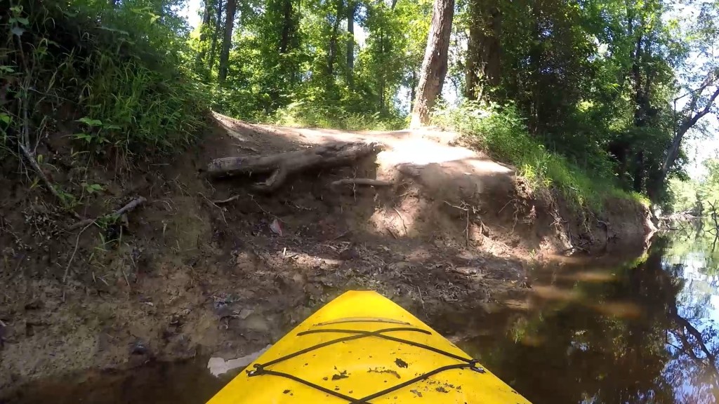
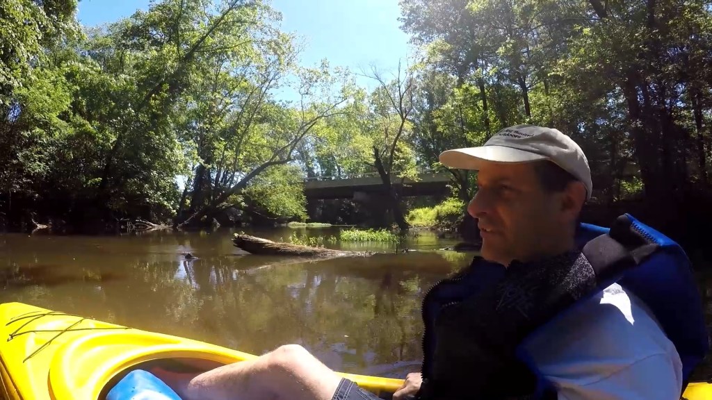
Again, Nelson Hill Landing is an excellent access point. The access along US 301 is downstream of the bridge, on the north side of the river – that is, on the right, just past the bridge as you’re travelling north on US 301. Parking is rather straightforward, but the bank here is fairly high and steep. Roots make a natural stairway to the water, but I imagine it’s easier taking out here than putting in.
The river continues to feel dark, isolated and tranquil. The river passes under Nelson Hill Road very quickly, and then soon after parallels the railroad for a short stretch. Then you’re on your own for about 5 miles until passing under the railroad, then another mile before passing under US 301. Takeout is on river left just downstream of the 301 bridge.
Finally, Mattaponi Bluffs Wildlife Management Area (WMA) borders the right bank through the center of this stretch. With an appropriate permit from the state of Virginia, this provides opportunities for primitive camping along the banks, creating overnight options.
Next Steps
The next stretch from 301 (coming soon!) is about 11 miles, with a takeout option at Reedy Mill Road. The road shuttle distance between these two points is only 6 miles, making it another attractive trip for a bicycle recovery.
Below that, an overnight trip is probably required, with a campsite in the Robert W. Duncan WMA between Reedy Mill and Dorell Rd, as access points get fewer and farther between. There are over 50 miles of navigable river between Bowling Green and Aylett, and then below Aylett the river widens and becomes tidal before merging with the Pamunkey and forming the York at West Point.
All of which is to say – there’s a lot of the Mattaponi yet to discover!
Get Out There!
