The Chesapeake and Ohio (C&O) Canal was built in the late 1700’s and through the early 1800’s to connect the goods and citizens on the East Coast of a young United States to what was then the western frontier, beyond the Blue Ridge and Allegheny Mountains. The utility of the canal was overcome by railroads in the early 20th century, and operation ceased in 1924, but the canal and its adjacent towpath are still in place, stretching from Washington, D.C. to Cumberland, MD.
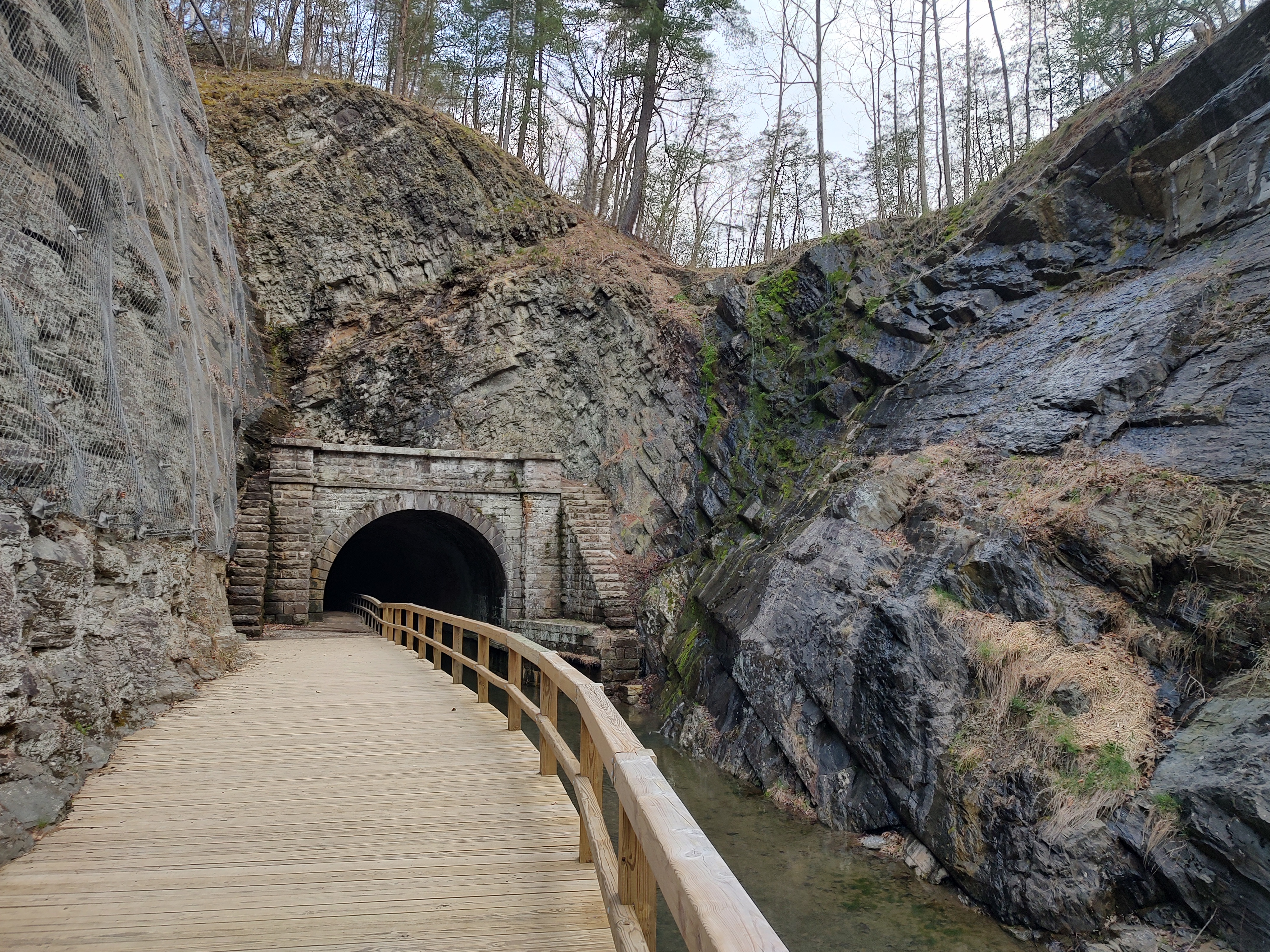
The canal follows the north bank of the Potomac River for most of its length, but just outside the town of Paw Paw, WV, the Potomac cuts through a series of Allegheny ridges in six miles of horseshoe bends with steep cliffs on both sides. Rather than face the impossible task of cutting a canal through this difficult terrain, engineers decided to cut through the mountain instead, ultimately creating a 3,113-foot (0.6 mile) tunnel for use by boats. The tunnel also required the accommodation of the towpath, so that mule drivers – the primary motive power for the barges using the canal – could continue to tow the vessels through the darkness.
Tunnel construction started in 1836 with an estimated total price of $33,500 and two years to complete. It actually took fourteen years, and by the time the tunnel opened in 1850, it had cost over $600,000 (about $24.5Million in 2025), and almost bankrupted the Chesapeake and Ohio Canal Company. In addition to the physical difficulty of excavating over a half-mile of mountain with hand tools and black powder, engineers found themselves fighting hard, but loose layers of shale that threatened to collapse the tunnel.
In addition, the project was plagued by labor disputes and frequent ethnic clashes between the English, Irish and German workers, including several riots in the nearby towns. Regardless, the tunnel was completed, and the canal opened all the way to Cumberland, though the investment made here forced the company to scrap plans to extend the canal all the way to Pittsburgh, which was the original plan. (Note, the Chesapeake and Ohio Canal never actually reached the Ohio River – But modern day hikers/bikers can complete the route by picking up the Great Allegheny Passage from Cumberland).

During operation, a railroad-style semaphore flag was installed at the southern end of the tunnel to indicate that the canal was in use, but that didn’t necessarily prevent boats from meeting in the middle, in the dark, causing arguments about who should go back. Loaded boats going downstream technically had the right of way, but that nicety didn’t always prevail. Mules had an equally challenging problem. The towpath through the tunnel is narrow enough that people couldn’t easily get by a stubborn animal. Passengers and operators would sometimes play music or sing in the tunnel, both to enjoy the echo and to keep up their courage through the dark passage.
Today, it’s easy to enjoy a walk through history along the canal towpath, and through the Paw Paw Tunnel. The easiest point of access is at the Paw Paw Campground along Rt. 9 just north of Paw Paw, WV (but across the Potomac, so in Maryland!) Trailhead parking is at: 39.54437, -78.46097.

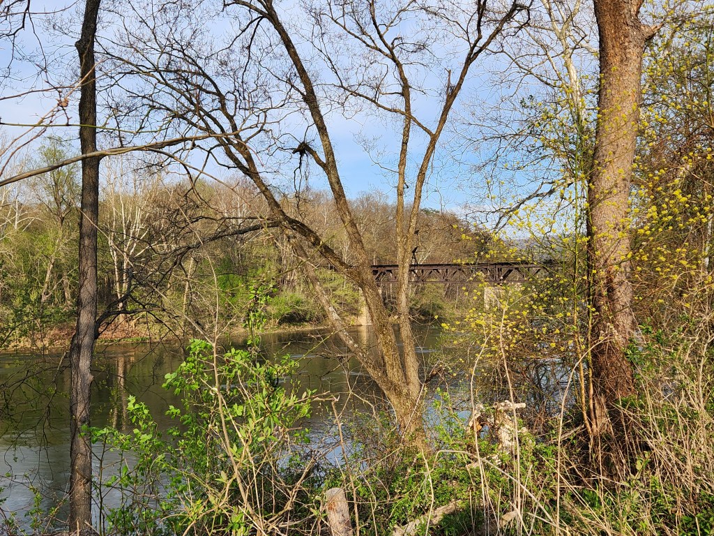
From here, a short spur trail leads to the C&O Canal Towpath and it’s a short half-mile along flat ground to the southern tunnel portal. When we visited in mid-April, the dogwoods and redwoods were blooming, frogs were calling and breeding in the shallow stagnant pools within the old canal, and the soft burble of the Potomac (flowing generally northward here) was audible for most of the walk.

Approaching the tunnel in hot weather (close to 90 deg F during our hike), we could feel occasional bubbles of cold air and the smell of raw earth emanating from the opening. The transition from hot, 90 deg weather to mid-50s inside was dramatic, but welcome. Inside, the canal was full of water, having been protected by darkness from the choking effect of vegetation over the years. Groundwater is constantly dripping through the bricked ceiling from the mountainside above, and the sound of a minor trickle falling into the water of the canal echoes loudly in some areas. At the same time, some stretches of the towpath are wet and filled with puddles, so tread carefully!


It gets dark quickly, and the tunnel’s length is deceiving. From one end of the tunnel, the light at the far end is essentially doubled by its reflection in the waters of the canal, so it appears as if maybe the tunnel is only a tenth of a mile long. As you become enveloped by darkness, though, the far portal appears to move farther and farther away. It’s definitely spooky, if you are inclined to think of it that way!

Emerging on the north end, the canal towpath follows a boardwalk through the significant gorge that was excavated here to provide a path for the canal, providing evidence that there was a lot of work to do here even when NOT building a tunnel. About a half-mile further on, you reach the intersection of the Tunnel Hill Trail. This path leads back up and over the mountain ridge, reconnecting with the towpath just outside the south portal. We elected NOT to climb up and over, given the heat, but I’m led to believe that there is additional historical information regarding the surveying, the ventilation and access shafts drilled into the tunnel from above, and the workers themselves.

Depending on the route you take, the out and back can be anywhere from about 2.2 miles (to north portal and back), to 4.8 miles (through tunnel one way, all the way to the Potomac, and over Tunnel Hill the other way). Regardless of the route, this is an excellent glimpse into history and a unique hike!
Get Out There!
